
Central Tigray topographic map
Interactive map
Click on the map to display elevation.
About this map
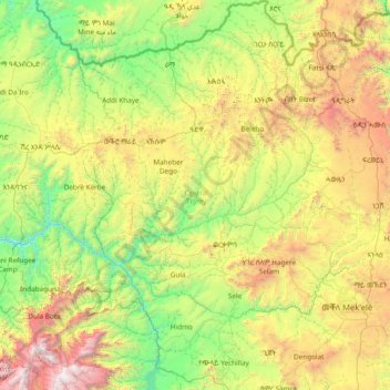
Name: Central Tigray topographic map, elevation, terrain.
Location: Central Tigray, Tigray, Ethiopia (13.18127 38.43336 14.65325 39.41747)
Average elevation: 1,898 m
Minimum elevation: 883 m
Maximum elevation: 4,457 m
Other topographic maps
Click on a map to view its topography, its elevation and its terrain.
Shire Enda Silassie
Ethiopia > Tigray > Shire Enda Silassie
Shire Enda Silassie, Western Tigray, Tigray, Ethiopia
Average elevation: 1,912 m