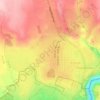
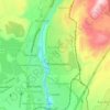
Zoravan topographic map
Click on the map to display elevation.
About this map

Name: Zoravan topographic map, elevation, terrain.
Location: Zoravan, Nairi community, Kotayk Province, Armenia (40.32151 44.44671 40.39271 44.57092)
Average elevation: 1,559 m
Minimum elevation: 1,291 m
Maximum elevation: 2,569 m
Other topographic maps
Click on a map to view its topography, its elevation and its terrain.


Azhdahak
Azhdahak (Armenian: Աժդահակ) is a volcano in Armenia, the highest point of Gegham mountains. It has an elevation of 3,597 m above sea. It is part of the Gegham Ridge volcanic field, which last erupted at 1900 BC ± 1000 years.
Average elevation: 3,316 m