
Westheide topographic map
Interactive map
Click on the map to display elevation.
About this map
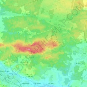
Name: Westheide topographic map, elevation, terrain.
Location: Westheide, Elbe-Heide, Börde, Saxony-Anhalt, Germany (52.26738 11.40277 52.39670 11.56909)
Average elevation: 74 m
Minimum elevation: 46 m
Maximum elevation: 139 m
Other topographic maps
Click on a map to view its topography, its elevation and its terrain.
Hohe Börde
Germany > Saxony-Anhalt > Börde
Hohe Börde, Börde, Saxony-Anhalt, 39167, Germany
Average elevation: 105 m
Hadmersleben
Germany > Saxony-Anhalt > Börde > Oschersleben
Hadmersleben, Oschersleben, Börde, Saxony-Anhalt, Germany
Average elevation: 87 m
Oschersleben
Germany > Saxony-Anhalt > Börde > Oschersleben
Oschersleben, Börde, Saxony-Anhalt, 39387, Germany
Average elevation: 112 m