
Básar topographic map
Interactive map
Click on the map to display elevation.
About this map
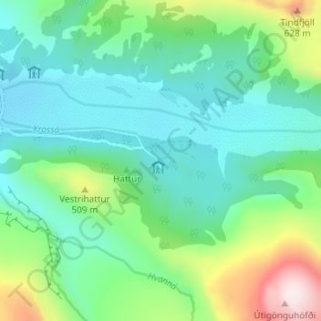
Name: Básar topographic map, elevation, terrain.
Location: Básar, Rangárþing eystra, Suðurland, Islande (63.66772 -19.49183 63.68772 -19.47183)
Average elevation: 354 m
Minimum elevation: 216 m
Maximum elevation: 765 m
Other topographic maps
Click on a map to view its topography, its elevation and its terrain.