
Make a donation
Gear up for your next adventure:
As an Amazon Associate, this site earns from qualifying purchases at no extra cost to you.
Heiligerlee topographic map
Click on the map to display elevation.
Make a donation
Gear up for your next adventure:
As an Amazon Associate, this site earns from qualifying purchases at no extra cost to you.
Heiligerlee
De uitgang -lee of -loo verwijst vermoedelijk naar een waterloop (-lee, leek, lits of lethe) of een beboste hoogte (-loo). Vergelijkbaar zijn de plaatsnamen Leek, Leens, De Lethe, de Lidden en Dunelee (beide verdronken in de Dollard), alsmede het verdronken dorp Jadeleh in de Jadeboezem. De tweede vorm spiegelt zich in de namen Vriescheloo (1316: Loo, 1470 Vriescheloe) en Lutjeloo. In het eerste geval valt te denken aan het riviertje de Rensel bij Winschoten, waarin een Oudfries woord rene ('stromen') met de uitgang -ele ('waterloop') verborgen zit. In het tweede geval zou het gaan om de beboste hoogte waarop het klooster is gesticht. De naam van het buurdorp Winsewida duidt eveneens op bebossing (-widu, -wida = 'woud, bos').
Make a donation
Gear up for your next adventure:
As an Amazon Associate, this site earns from qualifying purchases at no extra cost to you.
About this map
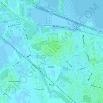
Name: Heiligerlee topographic map, elevation, terrain.
Location: Heiligerlee, Oldambt, Groningen, Nederland (53.14785 6.99511 53.16507 7.02016)
Average elevation: 1 m
Minimum elevation: -5 m
Maximum elevation: 6 m
Make a donation
Gear up for your next adventure:
As an Amazon Associate, this site earns from qualifying purchases at no extra cost to you.
Other topographic maps
Click on a map to view its topography, its elevation and its terrain.
Jipsinghuizen
Een kilometer ten zuidoosten van Jipsinghuizen werd in 1918 de Jipsinghuizersluis aangelegd in het Ruiten-Aa-kanaal, dat zelf in 1916 gereed kwam. Dit kanaal werd tot na de Tweede Wereldoorlog gebruikt door de beroepsvaart. Sinds de jaren negentig van de twintigste eeuw is het weer bevaarbaar voor de…
Average elevation: 6 m
Rhederbrug
Het gebied stond eerder als een deel van de Bovenstreek bekend, met achter de Leidijk de Veen- en Boekweitlanden van Bellingwolde. De zandweg naar Rhede dateert van omstreeks 1857. De eerste bebouwing langs deze weg dateert uit de tijd rond 1900. In 1902 opende de school (dan nog te Bovenstreek) zijn deuren.…
Average elevation: 2 m
Make a donation
Gear up for your next adventure:
As an Amazon Associate, this site earns from qualifying purchases at no extra cost to you.
Make a donation
Gear up for your next adventure:
As an Amazon Associate, this site earns from qualifying purchases at no extra cost to you.
Wessinghuizen
Nederland > Groningen > Onstwedde
De buurtschap behoort tot de oudere nederzettingen in de huidige gemeente Stadskanaal. Het werd gesticht op een zandhoogte langs de Ruiten Aa. De zandhoogte Jardinghkamp in het zuiden van de vroegere marke van Wessinghuizen wordt al genoemd in 1391, als vlak bij de buurtschap Egge Addinga, de Heer van…
Average elevation: 3 m
Make a donation
Gear up for your next adventure:
As an Amazon Associate, this site earns from qualifying purchases at no extra cost to you.
Make a donation
Gear up for your next adventure:
As an Amazon Associate, this site earns from qualifying purchases at no extra cost to you.
Make a donation
Gear up for your next adventure:
As an Amazon Associate, this site earns from qualifying purchases at no extra cost to you.
Make a donation
Gear up for your next adventure:
As an Amazon Associate, this site earns from qualifying purchases at no extra cost to you.
Make a donation
Gear up for your next adventure:
As an Amazon Associate, this site earns from qualifying purchases at no extra cost to you.
Make a donation
Gear up for your next adventure:
As an Amazon Associate, this site earns from qualifying purchases at no extra cost to you.
Make a donation
Gear up for your next adventure:
As an Amazon Associate, this site earns from qualifying purchases at no extra cost to you.
Make a donation
Gear up for your next adventure:
As an Amazon Associate, this site earns from qualifying purchases at no extra cost to you.
Make a donation
Gear up for your next adventure:
As an Amazon Associate, this site earns from qualifying purchases at no extra cost to you.
Make a donation
Gear up for your next adventure:
As an Amazon Associate, this site earns from qualifying purchases at no extra cost to you.
Make a donation
Gear up for your next adventure:
As an Amazon Associate, this site earns from qualifying purchases at no extra cost to you.
Make a donation
Gear up for your next adventure:
As an Amazon Associate, this site earns from qualifying purchases at no extra cost to you.
Zuidwending
Nederland > Groningen > Veendam
De opslag bestaat uit een gasinstallatie bovengronds en uit vijf cavernes, waarvan er in 2011 vier gereed waren en de laatste in 2013 gereed gekomen is. De cavernes liggen op een diepte van 1000 tot 1500 meter. Vier cavernes hebben een gemiddelde hoogte van 300 meter en een diameter van 50 tot 60 meter en…
Average elevation: 2 m
Make a donation
Gear up for your next adventure:
As an Amazon Associate, this site earns from qualifying purchases at no extra cost to you.
Make a donation
Gear up for your next adventure:
As an Amazon Associate, this site earns from qualifying purchases at no extra cost to you.
Make a donation
Gear up for your next adventure:
As an Amazon Associate, this site earns from qualifying purchases at no extra cost to you.
Bedum
Nederland > Groningen > Bedum > Bedum
Hoofdplaats: Uithuizen Dorpen: Adorp · Den Andel · Baflo · Bedum · Eenrum · Ellerhuizen · Eppenhuizen · Hornhuizen · Houwerzijl · Kantens · Kleine Huisjes · Kloosterburen · 't Lage van de Weg · Lauwersoog · Leens · Leenstertillen · Lutjewolde · Mensingeweer · Molenrij · Niekerk · Noordwolde…
Average elevation: 0 m
Make a donation
Gear up for your next adventure:
As an Amazon Associate, this site earns from qualifying purchases at no extra cost to you.
Oude Pekela
Nederland > Groningen > Oude Pekela > Oude Pekela
Oude Pekela had een levendige Joodse gemeenschap. Tot aan de jaren tachtig van de negentiende eeuw bleef de Joodse gemeente van Oude en Nieuwe Pekela groeien. In 1884 werd er nog een nieuwe synagoge met een ritueel bad en een onderwijzerswoning ingewijd. Op zijn hoogtepunt in 1870 telden beide Pekela's 401…
Average elevation: 1 m
Make a donation
Gear up for your next adventure:
As an Amazon Associate, this site earns from qualifying purchases at no extra cost to you.
Make a donation
Gear up for your next adventure:
As an Amazon Associate, this site earns from qualifying purchases at no extra cost to you.