
Ao Kathueng topographic map
Interactive map
Click on the map to display elevation.
About this map
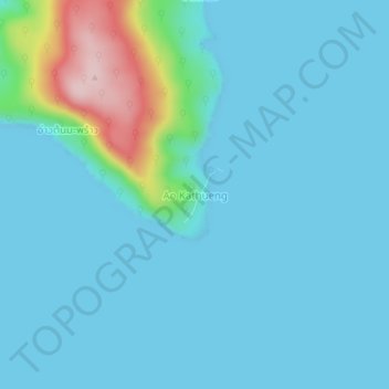
Name: Ao Kathueng topographic map, elevation, terrain.
Location: Ao Kathueng, Trat Province, Thailand (11.54625 102.57271 11.58625 102.61271)
Average elevation: 34 m
Minimum elevation: 0 m
Maximum elevation: 260 m
Other topographic maps
Click on a map to view its topography, its elevation and its terrain.