
Rushan City topographic map
Interactive map
Click on the map to display elevation.
About this map
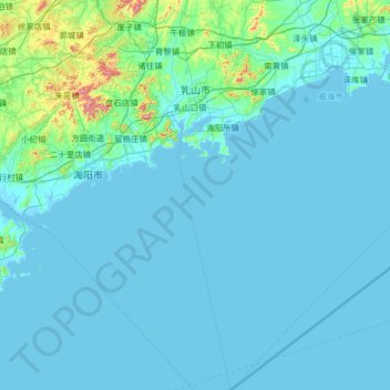
Name: Rushan City topographic map, elevation, terrain.
Location: Rushan City, Weihai, Shandong, 264500, China (36.11121 121.17463 37.14795 121.87091)
Average elevation: 30 m
Minimum elevation: -1 m
Maximum elevation: 560 m
Other topographic maps
Click on a map to view its topography, its elevation and its terrain.
Qingdao
Qingdao is located on the south facing coast of the Shandong Peninsula (German: Schantung Halbinsel). It borders three prefecture-level cities, namely Yantai to the northeast, Weifang to the west, and Rizhao to the southwest. The city's total jurisdiction area occupies 10,654 square kilometres (4,114 sq mi),…
Average elevation: 25 m