
Sutton topographic map
Interactive map
Click on the map to display elevation.
About this map
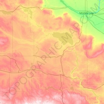
Name: Sutton topographic map, elevation, terrain.
Location: Sutton, Saskatchewan, Canada (49.27727 -106.84154 50.55727 -105.56154)
Average elevation: 721 m
Minimum elevation: 526 m
Maximum elevation: 1,002 m
Other topographic maps
Click on a map to view its topography, its elevation and its terrain.
Black Lake
Canada > Saskatchewan > Unorganized Division No. 18
Black Lake is a lake in the Mackenzie River drainage basin in northern Saskatchewan, Canada. It is about 55 kilometres (34 mi) long, 17 kilometres (11 mi) wide, has an area of 464 km2 (179 sq mi), and lies at an elevation of 281 metres (922 ft). The primary inflows are the Chipman River, Cree River, Fond du…
Average elevation: 317 m
Wollaston Lake
Canada > Saskatchewan > Northern Saskatchewan Administration District
Average elevation: 413 m