
Baxter County topographic map
Interactive map
Click on the map to display elevation.
Baxter County
Norfork Lake WMA is a series of protected walk-in hunting areas along Lake Norfork covered in hardwood forest with some pine and ranging topography. The four Baxter County units are Indian Head Unit, Chapin Point Unit, Seward Point Unit, and the Bennett's Creek Unit. The WMA is managed for deer, turkey and small game and attracts waterfowl during migration.
About this map
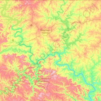
Name: Baxter County topographic map, elevation, terrain.
Location: Baxter County, Arkansas, United States (35.97355 -92.59547 36.49874 -92.15454)
Average elevation: 233 m
Minimum elevation: 95 m
Maximum elevation: 423 m
Other topographic maps
Click on a map to view its topography, its elevation and its terrain.
Magazine Mountain
United States > Arkansas > Logan County
Mount Magazine is often called "the highest point between the Alleghenies and the Rockies" (there are mountains located in the Trans-Pecos region of far-west Texas which exceed Mount Magazine in elevation and prominence, although the Trans-Pecos region lies so far south of the Rockies, that region arguably…
Average elevation: 670 m