
Punjab topographic map
Interactive map
Click on the map to display elevation.
Punjab
The Ravi River originates in the Himalayas in the Multhan tehsil of Kangra district of Himachal Pradesh, India. It follows a north-westerly course and is a perennial river. It is the smallest of the five Punjab rivers that rise from glacier fields at an elevation of 14,000 feet (4,300 m), on the southern side of the Mid Himalayas. It flows through Barabhangal, Bara Bansu, and Chamba districts. It flows in rapids in its initial reaches with boulders seen scattered in the bed of the river. The Ravi River in this reach flows in a gorge with a river bed slope of 183 feet per mile (34.7 m/km) and is mostly fed by snowmelt, as this region lies in a rain shadow. Two of its major tributaries, the Budhil and Nai or Dhona join 64 kilometres (40 mi) downstream from its source. The Budhil River rises in Lahul range of hills and is sourced from the Manimahesh Kailash Peak and the Manimahesh Lake, at an elevation of 4,080 metres (13,390 ft), and both are Hindu pilgrimage sites. The entire length of Budhil is 72 kilometres (45 mi) where it has a bed slope of 314 feet per mile (59.5 m/km). It flows through the ancient capital of Bharmwar, now known as Bharmour in Himachal Pradesh. During 1858–1860, the Raja of Bharmour had considered the Budhil valley as an excellent source of Deodar trees for supply to the British Raj. However, a part of the forest surrounding the temple was considered sacred and declared a reserved area. The second tributary, the Nai, rises at Kali Debi pass, and flows for 48 kilometres (30 mi), with a bed slope of 366 feet per mile (69.3 m/km), from its source at Trilokinath to its confluence with the Ravi. This valley was also exploited for its forest wealth during the English period.
About this map
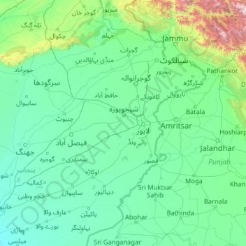
Name: Punjab topographic map, elevation, terrain.
Location: Punjab, Pakistan, Ravi River (30.54981 71.81849 32.61556 75.99168)
Average elevation: 356 m
Minimum elevation: 126 m
Maximum elevation: 4,848 m
Other topographic maps
Click on a map to view its topography, its elevation and its terrain.
Karachi
Pakistan > Sindh > Karachi South District > Saddar Town
Karachi lies very close to a major fault line, where the Indian tectonic plate meets the Arabian tectonic plate. Within the city of Karachi are two small ranges: the Khasa Hills and Mulri Hills, which lie in the northwest and act as a barrier between North Nazimabad and Orangi. Karachi's hills are barren and…
Average elevation: 20 m
Islamabad
Pakistan > Islamabad Capital Territory
Islamabad is located at 33°26′N 73°02′E / 33.43°N 73.04°E / 33.43; 73.04 at the northern edge of the Pothohar Plateau and at the foot of the Margalla Hills in Islamabad Capital Territory. Its elevation is 540 metres (1,770 ft). The modern capital and the ancient Gakhar city of Rawalpindi form…
Average elevation: 666 m
Khyber Pakhtunkhwa
Most precipitation falls as thunderstorms or snow during winter and spring, so that the climate at the lowest elevations is classed as Mediterranean (Csa), continental Mediterranean (Dsa) or semi-arid (BSk). Summers are extremely dry in the north of Chitral district and receive only a little rain in the south…
Average elevation: 2,135 m
K2
Pakistan > Gilgit-Baltistan > Shigar District
K2 is the only 8,000+ metre peak that has never been climbed from its eastern face. Ascents have almost always been made in July and August, which are typically the warmest times of the year; K2's more northern location makes it more susceptible to inclement and colder weather. The peak has now been climbed by…
Average elevation: 7,474 m
Nanga Parbat
Pakistan > Gilgit-Baltistan > Astore District
To the south, Nanga Parbat has what is often referred to as the highest mountain face in the world: the Rupal Face rises 4,600 m (15,090 ft) above its base. To the north, the complex, somewhat more gently-sloped Rakhiot Flank rises 7,000 m (23,000 ft) from the Indus River valley to the summit in just 25 km (16…
Average elevation: 7,086 m
Murree
Pakistan > Punjab > Murree District
Murree (Punjabi, Urdu: مری) is a mountain resort city, located in the Galyat region of the Pir Panjal Range, within the Muree District of Punjab, Pakistan. It forms the outskirts of the Islamabad-Rawalpindi metropolitan area, and is about 30 km (19 mi) northeast of Islamabad. It has average altitude of…
Average elevation: 1,718 m
Skardu
Pakistan > Gilgit-Baltistan > Skardu District
Skardu (Balti: སྐར་མདོ་་; Urdu: سکردو, romanized: skardū, pronounced [skərduː]) is a city located in Pakistani-administered Gilgit−Baltistan in the disputed Kashmir region. Skardu serves as the capital of Skardu District and the Baltistan Division. It is situated at an average…
Average elevation: 3,448 m
Battagram
Pakistan > Khyber Pakhtunkhwa > Battagram District
Battagram (Urdu: بٹگرام, Pashto: بټګرام) is a city and Union Council of Battagram District in Khyber Pakhtunkhwa Province of Pakistan. It is located at 34°41'N 73°1'E and has an altitude of 1038 metres (3408 feet).
Average elevation: 1,316 m
Indus
In the uppermost, highest part of the Indus River basin there are relatively few genera and species: Diptychus, Ptychobarbus, Schizopyge, Schizopygopsis and Schizothorax snowtrout, Triplophysa loaches, and the catfish Glyptosternon reticulatum. Going downstream these are soon joined by the golden mahseer Tor…
Average elevation: 60 m
Indus
Pakistan > Dadu District > Adam Panhwar
In the uppermost, highest part of the Indus River basin there are relatively few genera and species: Diptychus, Ptychobarbus, Schizopyge, Schizopygopsis and Schizothorax snowtrout, Triplophysa loaches, and the catfish Glyptosternon reticulatum. Going downstream these are soon joined by the golden mahseer Tor…
Average elevation: 39 m
Tirich Mir
Pakistan > Khyber Pakhtunkhwa > Chitrāl District > Torkhow-Molkhow Tehsil
The weather station 4,245 m (13,927 ft) above sea level lies in the Tundra climate/Alpine climate (ET) zone according to Köppen Climate Classification. On this specific altitude (4,245 m or 13,927 ft asl) we find moderately cold winters and cool summers generally above freezing. Annual mean temperature is…
Average elevation: 6,802 m
K2
Pakistan > Gilgit-Baltistan > Shigar District
Also occasionally known as Mount Godwin-Austen, other nicknames for K2 are The King of Mountains and The Mountaineers' Mountain, as well as The Mountain of Mountains after prominent Italian climber Reinhold Messner titled his book about K2 the same. Although the summit of Everest is at a higher altitude, K2 is…
Average elevation: 7,474 m
Indus
Pakistan > Khyber Pakhtunkhwa > Swabi District > Allāhdher
In the uppermost, highest part of the Indus River basin there are relatively few genera and species: Diptychus, Ptychobarbus, Schizopyge, Schizopygopsis and Schizothorax snowtrout, Triplophysa loaches, and the catfish Glyptosternon reticulatum. Going downstream these are soon joined by the golden mahseer Tor…
Average elevation: 281 m
K2
Pakistan > Gilgit-Baltistan > Shigar District
Also occasionally known as Mount Godwin-Austen, other nicknames for K2 are The King of Mountains and The Mountaineers' Mountain, as well as The Mountain of Mountains after prominent Italian climber Reinhold Messner titled his book about K2 the same. Although the summit of Everest is at a higher altitude, K2 is…
Average elevation: 7,474 m
Peshawar Cantonment
Pakistan > Khyber Pakhtunkhwa > Peshāwar District > Peshawar City Tehsil
Average elevation: 352 m
K2
Pakistan > Gilgit-Baltistan > Shigar District
Also occasionally known as Mount Godwin-Austen, other nicknames for K2 are The King of Mountains and The Mountaineers' Mountain, as well as The Mountain of Mountains after prominent Italian climber Reinhold Messner titled his book about K2 the same. Although the summit of Everest is at a higher altitude, K2 is…
Average elevation: 7,474 m
Saltoro Kangri
Pakistan > Gilgit-Baltistan > Ghanche District
The mountain underwent reconnaissance by Fanny Bullock Workman and her husband in the year 1911-12. The initial endeavor to conquer the peak, which was then denoted as "Peak 36," took place in 1935, led by a British expedition headed by James Waller and John Hunt. Hunt's involvement in the expedition had been…
Average elevation: 6,651 m
Chitral
Pakistan > Khyber Pakhtunkhwa > Chitrāl District
The city has an average elevation of 1,500 m (4,921 ft).
Average elevation: 2,982 m
Noshaq
Pakistan > Khyber Pakhtunkhwa > Chitrāl District > Torkhow-Molkhow Tehsil
Average elevation: 6,868 m
Drosh
Pakistan > Khyber Pakhtunkhwa > Chitrāl District
Drosh is low elevation and is a large village in Chitral District on the traditional trade route to Drosh-Jalalabad Road. Drosh is located on 35° 33' 33" N and 71° 47' 44" E on the banks of the Landai Sin River (Bashgal River) just above its intersection with the Kunar River (Chitral River), along the…
Average elevation: 1,851 m
Quetta
Quetta (/ˈkwɛtə/; Urdu: کوئٹہ; [ˈkweːʈə] (listen); Pashto: کوټه) is the tenth most populous city in Pakistan with a population of over 1.1 million. It is situated in south-west of the country close to the International border with Afghanistan. It is the capital of the province of Balochistan…
Average elevation: 1,968 m
Wahova
Pakistan > Punjab > Taunsa District
Vehowa, also spelled Vehova, is a Tehsil of Taunsa District of Punjab, Pakistan. Largely inhabited by the Khetran Baloch tribe, it is also called Tuman Khetran. The main languages spoken here are Saraiki, Balochi and Pashto. Located in southern part of the Punjab at 31°7'58N 70°30'46E, the tehsil has an…
Average elevation: 213 m
Chitral
Pakistan > Khyber Pakhtunkhwa > Chitrāl District
The city has an average elevation of 1,500 m (4,921 ft).
Average elevation: 2,982 m
Noshaq
Pakistan > Khyber Pakhtunkhwa > Chitrāl District > Torkhow-Molkhow Tehsil
Average elevation: 6,868 m