
Bonaire topographic map
Interactive map
Click on the map to display elevation.
Bonaire
While Bonaire has some hills and variations in altitude, Klein Bonaire's surface is quite level and just about two meters above sea level. Because Klein Bonaire is as yet undeveloped, the fringing reef system surrounding Klein Bonaire is pristine.
About this map
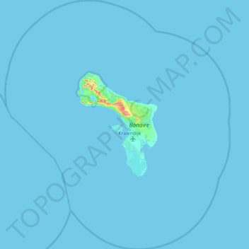
Name: Bonaire topographic map, elevation, terrain.
Location: Bonaire, Netherlands, 0000 BQ, Netherlands (11.82500 -68.62553 12.51200 -67.99163)
Average elevation: 1 m
Minimum elevation: -1 m
Maximum elevation: 165 m
Other topographic maps
Click on a map to view its topography, its elevation and its terrain.
Mount Scenery
Mount Scenery is an active volcano in the Caribbean Netherlands. Its lava dome forms the summit of the Saba island stratovolcano. At an elevation of 887 m (2,910 ft), it is the highest point in both the Kingdom of the Netherlands, and, since the dissolution of the Netherlands Antilles on 10 October 2010, the…
Average elevation: 339 m