Geolocate

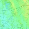
Lhee topographic map

Click on the map to display elevation.

About this map

Name: Lhee topographic map, elevation, terrain.

Location: Lhee, Dwingeloo, Westerveld, Drenthe, Netherlands, 7991 PK, Netherlands (52.80558 6.37398 52.84558 6.41398)

Average elevation: 11 m

Minimum elevation: 6 m

Maximum elevation: 17 m

Other topographic maps

Click on a map to view its topography, its elevation and its terrain.
Veenoord

Netherlands > Drenthe

Average elevation: 14 m

Rhee

Netherlands > Drenthe > Assen

Average elevation: 12 m

Meppel

Netherlands > Drenthe

Average elevation: 2 m

Assen

Netherlands > Drenthe

Average elevation: 12 m

Annerveenschekanaal

Netherlands > Drenthe

Average elevation: 2 m

Norg

Netherlands > Drenthe

Average elevation: 8 m

Odoorn

Netherlands > Drenthe

Average elevation: 22 m

Elp

Netherlands > Drenthe

Average elevation: 18 m

Gieten

Netherlands > Drenthe

Average elevation: 12 m

Amen

Netherlands > Drenthe

Average elevation: 16 m

Beilen

Netherlands > Drenthe

Average elevation: 14 m

Spier

Netherlands > Drenthe

Average elevation: 14 m

Midlaren

Netherlands > Drenthe

Average elevation: 4 m

Wilhelminaoord

Netherlands > Drenthe

Average elevation: 5 m

Roden

Netherlands > Drenthe

Average elevation: 5 m

Erica

Netherlands > Drenthe

Average elevation: 17 m

Tiendeveen

Netherlands > Drenthe

Average elevation: 15 m

Emmer-Compascuum

Netherlands > Drenthe

Average elevation: 15 m

Dwingeloo

Netherlands > Drenthe

Average elevation: 10 m

Hoogersmilde

Netherlands > Drenthe

Average elevation: 12 m

Coevorden

Netherlands > Drenthe

Average elevation: 15 m

Coevorden

Netherlands > Drenthe > Coevorden

Average elevation: 11 m

Ees

Netherlands > Drenthe

Average elevation: 18 m

Schipborg

Netherlands > Drenthe

Average elevation: 8 m

Havelte

Netherlands > Drenthe

Average elevation: 5 m

Zuidlaren

Netherlands > Drenthe

Average elevation: 5 m

Erica

Netherlands > Drenthe

Average elevation: 17 m

Assen

Netherlands > Drenthe

Average elevation: 12 m

Annerveenschekanaal

Netherlands > Drenthe

Average elevation: 2 m

Gear up for your next adventure:

🪓Outdoor Multitools - Versatile tools for hiking and camping
🧣Neck Gaiters - Versatile protection against wind and cold
🎒Backpack Rain Covers - Universal waterproof covers to protect your gear from downpours
🎒Hiking Child Carriers - Explore the outdoors with the whole family safely
🥾Hiking Boots - Waterproof and durable boots for long-distance hiking in the UK

As an Amazon Associate, this site earns from qualifying purchases at no extra cost to you.