
Tungestølen topographic map
Interactive map
Click on the map to display elevation.
About this map
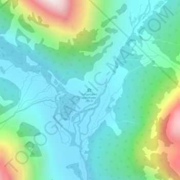
Name: Tungestølen topographic map, elevation, terrain.
Location: Tungestølen, Luster, Vestland, Norway (61.53403 6.96227 61.55403 6.98227)
Average elevation: 469 m
Minimum elevation: 239 m
Maximum elevation: 1,224 m
Other topographic maps
Click on a map to view its topography, its elevation and its terrain.
Norway
Norway's topography is defined by its rugged and varied terrain, shaped by ancient geological processes and glacial activity. Dominating the landscape are the Scandinavian Mountains, which run through the country and include peaks like Galdhøpiggen, the highest in Northern Europe at 2,469 meters (8,100 feet).…
Average elevation: 143 m
Sognefjorden
The inner end of the Sognefjord is southeast of a mountain range rising to about 2,000 metres (6,600 ft) above sea level and covered by the Jostedalsbreen, continental Europe's largest glacier. Thus the climate of the inner end of Sognefjorden and its branches are not as wet as on the outer coastline.…
Average elevation: 682 m
Finnmark
The county's interior parts are part of the great Finnmarksvidda plateau, with an elevation of 300 to 400 m (980 to 1,310 ft), with multiple lakes and river valleys. The plateau is famous for its tens of thousands of reindeer owned by the Sámi, and swarms of mosquitoes in midsummer. Finnmarksvidda makes up…
Average elevation: 227 m
Tromsø
Outside the city, large areas in the municipality are at some altitude and above the treeline with an alpine tundra climate (ET). The islands to the west at the outer seabord are milder in winter like Måsvik, making this part of the municipality a subpolar oceanic climate (Cfc) zone. The average date for…
Average elevation: 193 m
Norway
At 385,207 square kilometres (148,729 sq mi) (including Svalbard and Jan Mayen; 323,808 square kilometres (125,023 sq mi) without), much of the country is dominated by mountainous or high terrain, with a great variety of natural features caused by prehistoric glaciers and varied topography. The most noticeable…
Average elevation: 143 m
Hardangervidda National Park
The plateau is the largest peneplain (eroded plain) in Europe, covering an area of about 6,500 km2 (2,500 sq mi) at an average elevation of 1,100 metres (3,600 ft). The highest point on the plateau is at the top of the Hardangerjøkulen glacier, which reaches a height of 1,863 m (6,112 ft).
Average elevation: 1,183 m
Troms
Skibotn (elevation: 46 m or 151 ft) in Storfjord Municipality is the location in Norway which has recorded the most days per year with clear skies (no clouds). Winter temperatures in Målselv Municipality and Bardu Municipality can get down to −35 °C (−31 °F), while summer days can reach 30 °C (86 °F)…
Average elevation: 293 m
Dovre
The Dovre area is in a valley at fairly high altitude and isolated from the sea by mountain ranges, giving some rain shadow effect for Dovre. Dovre, with the town Dombås, has a subarctic climate (Dfc) with sparse precipitation. The driest season is late winter and spring, and the wettest season is summer.…
Average elevation: 1,195 m
Tromsø
Outside the city, large areas in the municipality are at some altitude and above the treeline with an alpine tundra climate (ET or ETh). The islands to the west at the outer seaboard are milder in winter like Måsvik, making this part of the municipality a (if the −3.0 °C (26.6 °F) isotherm is used)…
Average elevation: 193 m
Alta
The town of Alta and most of the municipality is located just below the 70th latitude and is closer to the North Pole than it is to much of Central Europe and the British Isles. The town is the northernmost settlement of urban significance in the European Economic Area, with municipalities north of Alta being…
Average elevation: 372 m