Geolocate

Tral topographic maps

Click on a map to view its topography, its elevation and its terrain.

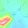
Tral

India > Jammu and Kashmir > Tral

Average elevation: 1,791 m

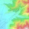
Batagund

India > Jammu and Kashmir > Tral

Average elevation: 1,771 m

Lam

India > Jammu and Kashmir > Tral

Average elevation: 2,269 m

Gear up for your next adventure:

🖼️Topographic Map Art - Decorative 3D-effect posters of famous UK peaks and regions
🌦️Portable Weather Meters - Handheld tools for monitoring weather conditions
🧣Neck Gaiters - Versatile protection against wind and cold
🍲Portable Camping Stoves - Fast-boiling stoves for hot meals on remote topographic survey trips
🕶️Glacier Goggles - Maximum protection for high-altitude snow topography

As an Amazon Associate, this site earns from qualifying purchases at no extra cost to you.