
Garowe District topographic map
Interactive map
Click on the map to display elevation.
About this map
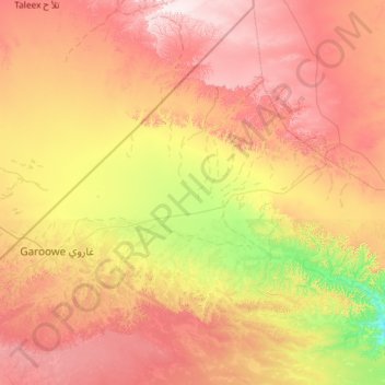
Name: Garowe District topographic map, elevation, terrain.
Location: Garowe District, Nugaal, Puntland, Somalia (8.02000 48.13000 9.13952 49.29902)
Average elevation: 530 m
Minimum elevation: 196 m
Maximum elevation: 936 m
Other topographic maps
Click on a map to view its topography, its elevation and its terrain.
Laa
Somalia > Nugaal > Eyl District
Laa, Eyl District, Nugaal, Puntland, Somalia
Average elevation: 54 m
Nugaal
Somalia > Nugaal > Garowe District
Nugaal, Garowe District, Nugaal, Puntland, Somalia
Average elevation: 390 m
Garoowe
Somalia > Nugaal > Garowe District
Garoowe, Garowe District, Nugaal, Puntland, Somalia
Average elevation: 486 m