
Eyl District topographic map
Interactive map
Click on the map to display elevation.
About this map
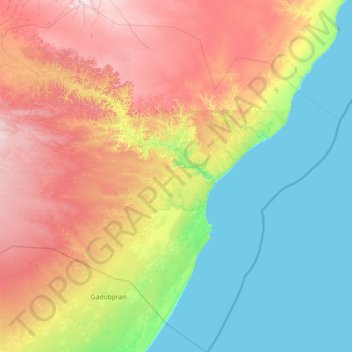
Name: Eyl District topographic map, elevation, terrain.
Location: Eyl District, Nugaal, Puntland, Somalia (7.28706 49.05046 8.68437 50.34218)
Average elevation: 223 m
Minimum elevation: 0 m
Maximum elevation: 662 m
Other topographic maps
Click on a map to view its topography, its elevation and its terrain.
Garoowe
Somalia > Nugaal > Garowe District
Garowe is situated in the Nugaal Valley, bounded by gradually ascending high plateaus that generally reach elevations of 500 to 1,000 metres (1,600 to 3,300 feet) above sea level on the north, west, and south. The western part of the same plateau is crossed by numerous valleys and dry watercourses. Raising…
Average elevation: 486 m