

Mississippi topographic map
Click on the map to display elevation.
Mississippi
Mississippi is entirely composed of lowlands, the highest point being Woodall Mountain, at 807 ft (246 m) above sea level, in the northeastern part of the state. The lowest point is sea level at the Gulf Coast. The state's mean elevation is 300 ft (91 m) above sea level.
About this map
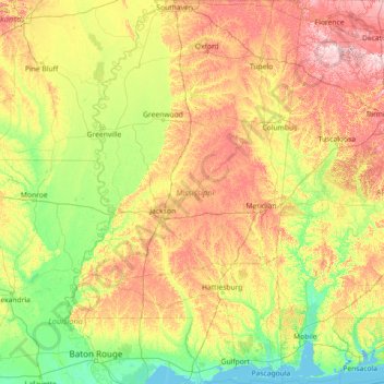
Name: Mississippi topographic map, elevation, terrain.
Location: Mississippi, United States (30.14368 -91.65501 34.99602 -88.09779)
Average elevation: 74 m
Minimum elevation: -3 m
Maximum elevation: 334 m
Other topographic maps
Click on a map to view its topography, its elevation and its terrain.

San Francisco Bay Area
United States > California > San Francisco
The San Francisco Bay Area is characterized by a diverse and dynamic topography shaped by geological processes over millions of years. This region features a combination of coastal plains, steep hills, and rugged mountains, all influenced by the tectonic activity associated with the nearby San Andreas Fault…
Average elevation: 113 m
Appalachian Mountains
United States > North Carolina > Yancey County
The Appalachian Mountains (French: Appalaches), often called the Appalachians, are a system of mountains in eastern to northeastern North America. The Appalachians first formed roughly 480 million years ago during the Ordovician Period. They once reached elevations similar to those of the Alps and the Rocky…
Average elevation: 1,463 m
Baltimore
United States > Maryland > Baltimore
Baltimore is in north-central Maryland on the Patapsco River close to where it empties into the Chesapeake Bay. The city is also located on the fall line between the Piedmont Plateau and the Atlantic coastal plain, which divides Baltimore into "lower city" and "upper city". The city's elevation ranges from sea…
Average elevation: 65 m
Hayden Valley
United States > Wyoming > Park County
A grassy valley, branching between low ridges, running from the river toward the center of the basin. A small stream rose in this valley, breaking through the ridges to the west in a deep cañon, and falling into the channel of the Yellowstone, which here bears in a northeast course, flowing in view as far as…
Average elevation: 2,373 m
Port Charlotte
United States > Florida > Charlotte County
Port Charlotte is characterized by a predominantly flat and low-lying terrain, typical of Florida’s coastal landscape. The area features a network of waterways, including the Peace River and Charlotte Harbor, which provide ample opportunities for recreational activities like boating and fishing. Elevations…
Average elevation: 4 m
Orlando
United States > Florida > Orange County
According to the Köppen climate classification, Orlando has a humid subtropical climate (Cfa) like much of the deep Southern United States. The two basic seasons in Orlando are a hot and rainy season, lasting from May until late October (roughly coinciding with the Atlantic hurricane season), and a warm and…
Average elevation: 29 m

Cape Canaveral
United States > Florida > Brevard County
The hurricane of August 1885, pushed a "wall of water" over the barrier island (elevation, 3.1 m (10 ft)) devastating Cape Canaveral and adjacent areas. The ocean waves flooded the homesteaders and discouraged further settlement in the area. The beach near the lighthouse was severely eroded prompting its…
Average elevation: 1 m
Palm Harbor
United States > Florida > Pinellas County
Palm Harbor is characterized by its unique topography, which features a relatively rare hilly landscape for the region. Unlike much of the surrounding areas in Pinellas County, which are predominantly flat, Palm Harbor includes elevations that can reach up to about 75 feet above sea level. This elevation gives…
Average elevation: 9 m


Jensen Beach
United States > Florida > Martin County
The Skyline Drive area includes some of the highest points in the community, reaching an elevation of 70 feet (21 m) at one point.
Average elevation: 5 m
Evergreen
United States > Colorado > Jefferson County > Evergreen
Evergreen sits at an elevation of 7,220 feet (2,200 m) in the Rocky Mountains, 19 miles west of Denver, Colorado. Its addresses are oriented according to the Street_system_of_Denver.
Average elevation: 2,309 m

Rocky Mountains
United States > Wyoming > Teton County
Agriculture and forestry are major industries. Agriculture includes dryland and irrigated farming and livestock grazing. Livestock are frequently moved between high-elevation summer pastures and low-elevation winter pastures, a practice known as transhumance.
Average elevation: 2,292 m
Central Park
United States > New York > New York
In June 1856, Fernando Wood appointed a "consulting board" of seven people, headed by author Washington Irving, to inspire public confidence in the proposed development. Wood hired military engineer Egbert Ludovicus Viele as the park's chief engineer, tasking him with a topographical survey of the site. The…
Average elevation: 26 m


Cajon Pass
United States > California > San Bernardino County
Cajon Pass (/kəˈhoʊn/; Spanish: Puerto del Cajón or Paso del Cajón) is a mountain pass between the San Bernardino Mountains to the east and the San Gabriel Mountains to the west in Southern California. Created by the movements of the San Andreas Fault, it has an elevation of 3,777 ft (1,151 m). Located in…
Average elevation: 1,169 m
Flagstaff
United States > Arizona > Coconino County
Flagstaff, the county seat of Coconino County. According to the United States Census Bureau, the city has a total area of 63.9 square miles (165.5 km2), of which only 0.03 square miles (0.08 km2) (0.08%) is water. Flagstaff lies at approximately 7,000 feet (2,130 m) elevation, and is surrounded by the largest…
Average elevation: 2,176 m


Rock Cut State Park
United States > Illinois > Winnebago County > Machesney Park
Average elevation: 265 m

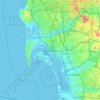
San Diego
United States > California > San Diego County > San Diego
The climate in San Diego, like most of Southern California, often varies significantly over short geographical distances, resulting in microclimates. In San Diego, this is mostly because of the city's topography (the Bay, and the numerous hills, mountains, and canyons). Frequently, particularly during the "May…
Average elevation: 57 m

Oak Creek Canyon
United States > Arizona > Coconino County
Oak Creek Canyon is about 12 miles (19 km) long, ranging in width from 0.8 to 2.5 miles (1.3 to 4.0 km). The depth of the canyon ranges from 800 to 2,000 feet (240 to 610 m). However, due to the faulting that played a major role in its formation, the west rim of the canyon is 700 feet (210 m) higher than the…
Average elevation: 1,859 m




Berthoud Pass
United States > Colorado > Clear Creek County
Berthoud Pass (/ˈbɜːrθəd/ BURTH-əd; elevation 11,307 ft (3,446 m)) is a high mountain pass in central Colorado, in the Front Range of the Rocky Mountains of the western United States.
Average elevation: 3,483 m
Multnomah Falls
United States > Oregon > Multnomah County
The falls drops in two major steps, split into an upper falls of 542 feet (165 m) and a lower falls of 69 feet (21 m), with a gradual 9 foot (3 m) drop in elevation between the two, so the total height of the waterfall is conventionally given as 620 feet (189 m). The two drops are due to a zone of more easily…
Average elevation: 270 m


Lake George
United States > Colorado > Park County
About 42.3 miles (68.1 km) northwest of Colorado Springs and 7.3 miles (11.7 km) northwest of Florissant, the town of Lake George was established in 1891 as a railroad stop for the Colorado Midland Railway (CM) which had been completed in 1887. The town and nearby lake—to its west and fed by the South Platte…
Average elevation: 2,543 m


Newport Beach
United States > California > Orange County > Newport Beach > Newport Beach
Newport Beach extends in elevation from sea level to the 1,161 ft (354 m) summit of Signal Peak in the San Joaquin Hills, but the official elevation is 25 ft (7.6 m) above sea level at a location of 33°37′0″N 117°53′51″W / 33.61667°N 117.89750°W / 33.61667; -117.89750 (33.616671, −117.897604).
Average elevation: 9 m
Scottsdale
United States > Arizona > Maricopa County > Scottsdale
The city is in the Salt River Valley, or the "Valley of the Sun," in the northern reaches of the Sonoran Desert. Scottsdale, 31 mi (50 km) long and 11.4 mi (18.3 km) wide at its widest point, shares boundaries with many other municipalities and entities. On the west, Scottsdale is bordered by Phoenix, Paradise…
Average elevation: 414 m

San Fernando Valley
United States > California > Los Angeles County > Los Angeles
Average elevation: 496 m




Twain Harte
United States > California > Tuolumne County
Twain Harte is situated in Tuolumne County along Highway 108 at an elevation of 3,640 feet (1,110 m).
Average elevation: 1,123 m

Mauna Kea
United States > Hawaii > Hawaiʻi County
Mauna Kea (/ˌmaʊnə ˈkeɪə/; Hawaiian: [ˈmɐwnə ˈkɛjə]; abbreviation for Mauna a Wākea) is a dormant volcano on the island of Hawaiʻi. Its peak is 4,207.3 m (13,803 ft) above sea level, making it the highest point in the state of Hawaiʻi and second-highest peak of an island on Earth. The peak is…
Average elevation: 3,978 m
Mount Saint Helens
United States > Washington > Skamania County
The Mount St. Helens major eruption of May 18, 1980 remains the deadliest and most economically destructive volcanic event in U.S. history. Fifty-seven people were killed; 200 homes, 47 bridges, 15 miles (24 km) of railways, and 185 miles (298 km) of highway were destroyed. A massive debris avalanche,…
Average elevation: 2,096 m
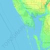
Appalachian Mountains
United States > North Carolina > Yancey County
The Appalachian Mountains (French: Appalaches), often called the Appalachians, are a system of mountains in eastern to northeastern North America. The Appalachians first formed roughly 480 million years ago during the Ordovician Period. They once reached elevations similar to those of the Alps and the Rocky…
Average elevation: 1,463 m
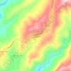

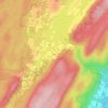
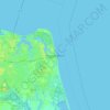
Virginia Beach
United States > Virginia > Virginia Beach
According to the United States Census Bureau, the city has a total area of 497 square miles (1,290 km2), of which 249 square miles (640 km2) is land and 248 square miles (640 km2) (49.9%) is water. It is the largest city in Virginia by total area and third-largest city land area. The average elevation is 12…
Average elevation: 2 m

Live Oak
United States > California > Santa Cruz County > Live Oak
Live Oak is a census-designated place (CDP) in Santa Cruz County, California between the cities of Santa Cruz and Capitola and north of the former Union Pacific railroad. Live Oak sits at an elevation of 102 feet (31 m). The population was 17,038 at the 2020 census. The population of the greater Live Oak area,…
Average elevation: 47 m


General Sherman Tree
United States > California > Tulare County
General Sherman is a giant sequoia (Sequoiadendron giganteum) tree located at an elevation of 2,109 m (6,919 ft) above sea level in the Giant Forest of Sequoia National Park in Tulare County, in the U.S. state of California. By volume, it is the largest known living single-stem tree on Earth.
Average elevation: 2,114 m

Palmyra Atoll
In 1962, the Department of Defense used Palmyra as an observation site during several high-altitude nuclear weapons tests high above Johnston Atoll. A group of about ten men supported the observation posts during this series of tests, while about 40 people carried out the observations.
Average elevation: 0 m
Ponte Vedra Beach
United States > Florida > Saint Johns County > Ponte Vedra Beach
Ponte Vedra Beach is characterized by its gently rolling terrain that is primarily flat and lies only about 15 feet above sea level. The landscape is predominantly shaped by coastal dunes and the proximity to the Atlantic Ocean, resulting in sandy beaches interspersed with vegetation typical of barrier island…
Average elevation: 3 m


Donner Peak
United States > California > Placer County
Donner Peak is an 8,019-foot-elevation (2,444-meter) summit in Placer County, California, United States.
Average elevation: 2,171 m



Johnston Island
The climate is tropical but generally dry. Northeast trade winds are consistent and there is little seasonal temperature variation. With elevation ranging from sea level to 5 m (16 ft) at Summit Peak, the islands contain some low-growing vegetation and palm trees on mostly flat terrain, and no natural fresh…
Average elevation: 1 m