
Brasted topographic map
Interactive map
Click on the map to display elevation.
About this map
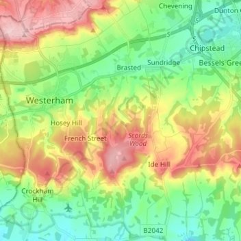
Name: Brasted topographic map, elevation, terrain.
Location: Brasted, Sevenoaks, Kent, England, United Kingdom (51.22236 0.08150 51.29890 0.12091)
Average elevation: 134 m
Minimum elevation: 59 m
Maximum elevation: 253 m
Kent trails, hiking, mountain biking, running and outdoor activities
Other topographic maps
Click on a map to view its topography, its elevation and its terrain.
Knatts Valley
United Kingdom > England > Kent > Sevenoaks > East Hill > Knockmill
Average elevation: 170 m