
Hosey Hill topographic map
Interactive map
Click on the map to display elevation.
About this map
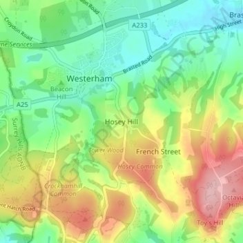
Name: Hosey Hill topographic map, elevation, terrain.
Location: Hosey Hill, Sevenoaks, Kent, England, TN16 1TA, United Kingdom (51.24003 0.05903 51.28003 0.09903)
Average elevation: 151 m
Minimum elevation: 90 m
Maximum elevation: 244 m
Kent trails, hiking, mountain biking, running and outdoor activities
Other topographic maps
Click on a map to view its topography, its elevation and its terrain.