
Sevenoaks Weald topographic map
Interactive map
Click on the map to display elevation.
About this map
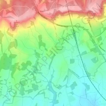
Name: Sevenoaks Weald topographic map, elevation, terrain.
Location: Sevenoaks Weald, Sevenoaks, Kent, England, United Kingdom (51.21809 0.16141 51.25236 0.21903)
Average elevation: 112 m
Minimum elevation: 44 m
Maximum elevation: 218 m
Kent trails, hiking, mountain biking, running and outdoor activities
Other topographic maps
Click on a map to view its topography, its elevation and its terrain.
Knatts Valley
United Kingdom > England > Kent > Sevenoaks > East Hill > Knockmill
Average elevation: 170 m