
Holland topographic map
Click on the map to display elevation.
About this map
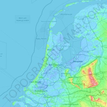
Name: Holland topographic map, elevation, terrain.
Location: Holland, Netherlands (51.64378 3.77368 53.47158 5.65538)
Average elevation: 2 m
Minimum elevation: -8 m
Maximum elevation: 105 m
Other topographic maps
Click on a map to view its topography, its elevation and its terrain.