
Kapuas Hulu topographic map
Interactive map
Click on the map to display elevation.
About this map
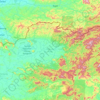
Name: Kapuas Hulu topographic map, elevation, terrain.
Location: Kapuas Hulu, West Kalimantan, Kalimantan, Indonesia (0.06623 111.53051 1.58840 114.20543)
Average elevation: 303 m
Minimum elevation: 0 m
Maximum elevation: 1,842 m
Other topographic maps
Click on a map to view its topography, its elevation and its terrain.