
Adla topographic map
Interactive map
Click on the map to display elevation.
About this map
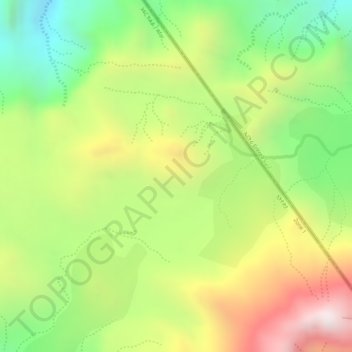
Name: Adla topographic map, elevation, terrain.
Location: Adla, Zone 1, Afar, Éthiopie (12.47417 42.37528 12.49417 42.39528)
Average elevation: 1,512 m
Minimum elevation: 1,152 m
Maximum elevation: 1,907 m
Other topographic maps
Click on a map to view its topography, its elevation and its terrain.
Danakil Depression
Danakil Depression, Zone 2, Afar, Éthiopie
Average elevation: -105 m
Yangudi Rassa National Park
Yangudi Rassa National Park, 18, Zone 3, Afar, Éthiopie
Average elevation: 622 m