
Hunza topographic map
Click on the map to display elevation.
About this map
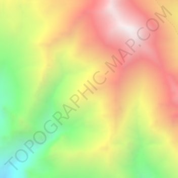
Name: Hunza topographic map, elevation, terrain.
Location: Hunza, Gilgit-Baltistan, Pakistan (36.49995 75.49995 36.50005 75.50005)
Average elevation: 5,039 m
Minimum elevation: 4,257 m
Maximum elevation: 5,737 m
Other topographic maps
Click on a map to view its topography, its elevation and its terrain.
Indus River
Pakistan > Gilgit-Baltistan > Kharmang District > Manthokha
In the uppermost, highest part of the Indus River basin there are relatively few genera and species: Diptychus, Ptychobarbus, Schizopyge, Schizopygopsis and Schizothorax snowtrout, Triplophysa loaches, and the catfish Glyptosternon reticulatum. Going downstream these are soon joined by the golden mahseer Tor…
Average elevation: 2,956 m
Ishkoman Tehsil
Pakistan > Gilgit-Baltistan > Ghizer District
The Ishkoman (Urdu: اشکومن) valley lies in the north of Ghizer District in Gilgit-Baltistan, Pakistan. It borders Afghanistan and the Pamir Wakhan Corridor. Its altitude ranges from 7,000 to 12,000 feet (2,100 to 3,700 m) above sea level. The languages spoken here include Shina, Khowar, Brushaski and Wakhi.
Average elevation: 4,324 m
Indus River
Pakistan > Gilgit-Baltistan > Kharmang District > Manthokha
In the uppermost, highest part of the Indus River basin there are relatively few genera and species: Diptychus, Ptychobarbus, Schizopyge, Schizopygopsis and Schizothorax snowtrout, Triplophysa loaches, and the catfish Glyptosternon reticulatum. Going downstream these are soon joined by the golden mahseer Tor…
Average elevation: 2,956 m
Deosai National Park
Deosai National Park (Urdu: دیوسائی باغ ملی) is a high-altitude alpine plain and national park located between the Skardu District and Astore District in Gilgit-Baltistan, Pakistan. Lying to the east of Nanga Parbat and in the western Himalayas, close to the central Karakoram Range surrounded by…
Average elevation: 4,310 m
Indus River
Pakistan > Gilgit-Baltistan > Kharmang District > Manthokha
In the uppermost, highest part of the Indus River basin there are relatively few genera and species: Diptychus, Ptychobarbus, Schizopyge, Schizopygopsis and Schizothorax snowtrout, Triplophysa loaches, and the catfish Glyptosternon reticulatum. Going downstream these are soon joined by the golden mahseer Tor…
Average elevation: 2,956 m
Biafo Glacier
Pakistan > Gilgit-Baltistan > Shigar District
Biafo Glacier converging at Hispar La with 49 kilometres (30 mi) long Hispar Glacier situated at an elevation of 5,128 metres (16,824 ft), forms the glacial system considered as the world's longest non-polar glacial system which spans an overall distance of around 120 kilometres (75 mi). This frozen pathway…
Average elevation: 4,618 m
Indus River
Pakistan > Gilgit-Baltistan > Kharmang District > Manthokha
In the uppermost, highest part of the Indus River basin there are relatively few genera and species: Diptychus, Ptychobarbus, Schizopyge, Schizopygopsis and Schizothorax snowtrout, Triplophysa loaches, and the catfish Glyptosternon reticulatum. Going downstream these are soon joined by the golden mahseer Tor…
Average elevation: 2,956 m