
Madison County topographic map
Click on the map to display elevation.
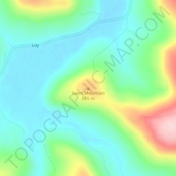
About this map
Name: Madison County topographic map, elevation, terrain.
Average elevation: 476 m
Minimum elevation: 411 m
Maximum elevation: 645 m
Other topographic maps
Click on a map to view its topography, its elevation and its terrain.
Fayetteville
United States > Arkansas > Washington County
Fayetteville is nestled in the picturesque Ozark Mountains, characterized by rolling hills, lush forests, and scenic valleys that define the region's topography. The elevation in Fayetteville ranges from about 1,100 feet to over 1,500 feet above sea level, creating a varied landscape that features steep ridges…
Average elevation: 401 m
Fort Smith
United States > Arkansas > Sebastian County
The United States acquired this territory and large areas west of the Mississippi River from France in the Louisiana Purchase (1803). Soon after, the government sent the Pike Expedition (1806) to explore the areas along the Arkansas River. The US founded Fort Smith in 1817 as a military post. It was named…
Average elevation: 140 m
Newton County
Newton County lies almost entirely within the rugged Boston Mountain range of the Ozark Mountains where elevations exceed 2,500 feet (760 m). The Buffalo National River, a popular destination for canoeing and recreation, runs through the county from west to east. Highway 7, which traverses the county from…
Average elevation: 486 m
Boone County
The county lies entirely within the Ozark Mountains. Rolling hills of the Springfield and Salem Plateaus characterize the majority of the topography, with the more rugged Boston Mountains lying just to the south. Isolated peaks of the Boston Mountain range are found in the south, including Boat Mountain,…
Average elevation: 357 m
Eureka Springs
United States > Arkansas > Carroll County
It is a tourist destination for its unique character as a Victorian resort, which first attracted visitors to use its then believed healing springs. The city has steep winding streets filled with Victorian-style cottages and manors. The historic commercial downtown of the city has an extensive streetscape of…
Average elevation: 411 m
Baxter County
Norfork Lake Wildlife Management Area (WMA) is a series of protected walk-in hunting areas along Lake Norfork covered in hardwood forest with some pine and ranging topography. The four Baxter County units are Indian Head Unit, Chapin Point Unit, Seward Point Unit, and the Bennett's Creek Unit. The WMA is…
Average elevation: 233 m
Yell County
Upon settlement, Yell County's varied topography created a stratified society, splitting settlers between the more fertile and productive farms of the "lowlands" and the subsistence farming of the steep and less-productive mountain soil of the "uplands". A planter class emerged in the lowlands, and as…
Average elevation: 218 m
Bradley County
A Topographic map of Bradley County is at https://en-us.topographic-map.com/maps/ettn/Bradley-County/
Average elevation: 47 m
Washington County
The economy of Washington County was based on apples in the late 19th century. A mixture of wet weather, altitude, and loamy soils provided a good environment for apple orchards. First planted in areas around Lincoln, Evansville, and Cane Hill in the 1830s, apple orchards began all across the county. The…
Average elevation: 424 m
Cross County
Roughly the western third of the county is within the Western Lowlands Pleistocene Valley Train subregion of the Delta. This region is characterized as flat windblown deposits of silty, sandy soils, and loess with a high groundwater table. Post oak and loblolly pine are native in the higher elevations, with…
Average elevation: 73 m
Bentonville
United States > Arkansas > Benton County
Bentonville lies in the humid subtropical climate zone (Köppen Cfa) with influence from the humid continental climate type. Bentonville experiences all four seasons and does receive cold air masses from the north, however some of the Arctic masses are blocked by the higher elevations of the Ozarks. July is…
Average elevation: 387 m
Buffalo National River
United States > Arkansas > Newton County
Along the upper river, the gradient is steep and the water is fast, leveling and slowing as the river runs its course. The upper section has most of the whitewater rapids to be found along the river, and features dramatic karst topography including sink holes and caves, springs, and waterfalls, over 500-foot…
Average elevation: 444 m
Bella Vista
United States > Arkansas > Benton County
The city of Bella Vista is located on the Springfield Plateau of the Ozark Mountains. Oak/hickory forests, along with valleys, creeks, and steep rises, characterize the city's topography. Bella Vista is located north of Bentonville and Rogers within the Northwest Arkansas region. The city has been experiencing…
Average elevation: 372 m
Hot Springs Village
United States > Arkansas > Garland County > Hot Springs Village
Average elevation: 227 m
Pine Bluff
United States > Arkansas > Jefferson County
The city is situated in the Southeast section of the Arkansas Delta and straddles the Arkansas Timberlands region to its west. Its topography is flat with wide expanses of farmland, similar to other places in the Delta Lowlands. Pine Bluff has numerous creeks, streams, and bayous, including Bayou Bartholomew,…
Average elevation: 69 m