
中川村 topographic map
Interactive map
Click on the map to display elevation.
About this map
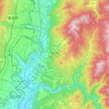
Name: 中川村 topographic map, elevation, terrain.
Location: 中川村, 上伊那郡, 長野県, 399-3804, 日本 (35.59715 137.89887 35.68570 138.03940)
Average elevation: 809 m
Minimum elevation: 451 m
Maximum elevation: 1,442 m
Other topographic maps
Click on a map to view its topography, its elevation and its terrain.