
辰野町 topographic map
Interactive map
Click on the map to display elevation.
About this map
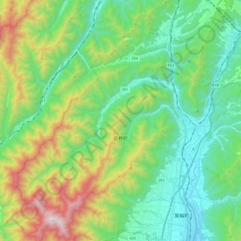
Name: 辰野町 topographic map, elevation, terrain.
Location: 辰野町, 上伊那郡, 長野県, 中部地方, 日本 (35.90827 137.82887 36.06403 138.04882)
Average elevation: 1,127 m
Minimum elevation: 666 m
Maximum elevation: 2,280 m
Other topographic maps
Click on a map to view its topography, its elevation and its terrain.