
Kayong Utara topographic map
Interactive map
Click on the map to display elevation.
About this map
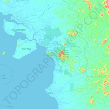
Name: Kayong Utara topographic map, elevation, terrain.
Location: Kayong Utara, West Kalimantan, Kalimantan, Indonesia (-1.74455 108.67719 -0.72303 110.42181)
Average elevation: 44 m
Minimum elevation: -2 m
Maximum elevation: 1,158 m
Other topographic maps
Click on a map to view its topography, its elevation and its terrain.