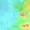
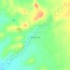
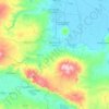
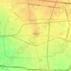
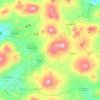
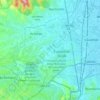
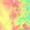
Santa Fe topographic map
Click on the map to display elevation.
About this map
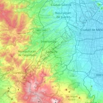
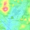
Name: Santa Fe topographic map, elevation, terrain.
Location: Santa Fe, Mexico City, 05348, Mexico (19.20433 -99.43041 19.52433 -99.11041)
Average elevation: 2,691 m
Minimum elevation: 2,229 m
Maximum elevation: 3,923 m
Other topographic maps
Click on a map to view its topography, its elevation and its terrain.
Durango
With 123,451.2 km2 or 12.3 million ha, Durango accounts for about 6.3% of the entire territory of Mexico. It is the fourth largest state lying at the extreme northwest of the Central Mexican Plateau, where it meets the Sierra Madre Occidental—the highest peaks in the state. The state has an average elevation…
Average elevation: 1,954 m
Cozumel
Large parts of the island are covered with mangrove forest which has many endemic animal species. Cozumel is a flat island based on limestone, resulting in a karst topography. The highest natural point on the island is less than 15 m (49 ft) above sea level. The cenotes are deep water-filled sinkholes formed…
Average elevation: 1 m
Guadalajara
Under the Köppen climate classification, Guadalajara has a humid subtropical climate (Cwa) that is quite close to a tropical climate, featuring dry, warm winters and hot, wet summers. Guadalajara's climate is influenced by its high altitude and the general seasonality of precipitation patterns in western…
Average elevation: 1,543 m
Monterrey
The city of Monterrey is 540 metres (1,770 ft) above sea level in the northeastern state of Nuevo León. Monterrey translated from Spanish to English is "King Mount" or "King mountain", which refers to the city's topography and the large mountains that surround it. The Santa Catarina River—dry most of the…
Average elevation: 861 m
Tepehuanes
Tepehuanes is a municipality in the Mexican state of Durango. It is located in the North West of Durango at 25°12'"-26°25'"N 105°23'"-106°40'"W, at an elevation of about 1,830 meters (6000 feet).
Average elevation: 2,234 m
Zapopan
Most of the municipality is flat with another quarter having rolling hills. Altitude varies from 1,500 to 2,000 metres (4,900 to 6,600 ft) above sea level. The main elevations are in the Sierra de la Primavera and include Nejahuete, Tajo and El Chapulin. Superficial water flows mostly in arroyos east to the…
Average elevation: 1,586 m
Nocupétaro
The municipality of Nocupétaro is located in the Tierra Caliente region of Michoacán at an elevation between 500 and 1,800 metres (1,600–5,900 ft). It borders the municipalities of Madero to the north, Carácuaro to the east, Turicato to the southwest, and Tacámbaro to the northwest. The municipality…
Average elevation: 934 m
Arandas
Arandas is situated on the Mesa Central at an elevation of 6,762 feet (2,061 metres). Arandas is commonly known among Mexicans as the commercial and manufacturing centre for agricultural products (typically beans and wheat) and its pastoral environment, which allows the city to produce various commercial…
Average elevation: 2,031 m
Cedros Island
Mexico > Baja California > Municipio de Ensenada
Cedros Island (Isla de Cedros, "island of cedars" in Spanish) is an island in the Pacific Ocean belonging to the state of Baja California, Mexico. The dry and rocky island had a population of 1,350 in 2005 and has an area of 348 square kilometres (134 sq mi) which includes the area of several small nearby…
Average elevation: 67 m


Isla Cozumel
Mexico > Quintana Roo > Cozumel
Large parts of the island are covered with mangrove forest which has many endemic animal species. Cozumel is a flat island based on limestone, resulting in a karst topography. The highest natural point on the island is less than 15 m (49 ft) above sea level. The cenotes are water-filled sinkholes formed by…
Average elevation: 2 m
Milpa Alta
It has an average altitude of 2,420 meters above sea level with altitudes varying between 2,300 and 3,600. It is part of the Trans-Mexican Volcanic Belt and the Sierra Chichinautzin volcanic mountain chain, which separates Mexico City from the state of Morelos. The borough is divided into three zones:…
Average elevation: 2,842 m
Las Sendas
Mexico > Nuevo León > San Pedro Garza García > Zona Valle Poniente
Average elevation: 720 m
La Magdalena Contreras
La Magdalena Contreras (Spanish pronunciation: [maɣðaˈlena konˈtɾeɾas] ) is a borough (demarcación territorial) in the Mexico City. As of the 2010 census, it has a population of 239,086 inhabitants and is the third-least populous of Mexico City's boroughs. It lies at an elevation of 2,365 m (7,759 ft)…
Average elevation: 2,828 m
Cabo Corrientes
Cabo Corrientes is in the west of the state, on the Pacific Ocean. Elevations range from sea level to 1,085 metres (3,560 ft). The Bahía de Banderas is to the north, Puerto Vallarta to the northeast, Talpa de Allende to the east, Tomatlán to the south, and the Pacific Ocean to the west.
Average elevation: 348 m
Acolman
The municipality is located on a plain in the northern portion of the Valley of Mexico called the Valley of Teotihuacan. It has only three significant elevations. The eastern border is marked by the Sierra de Patlachique and the west is marked by a mountain called Chiconautla. Chiconautla and Tlahuilco are…
Average elevation: 2,298 m
Parque Estatal Manantial de la Media Luna
Mexico > San Luis Potosi > Rioverde
Average elevation: 1,006 m