Geolocate

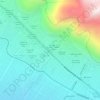
Lomas topographic map

Click on the map to display elevation.

About this map

Name: Lomas topographic map, elevation, terrain.

Location: Lomas, Province of Caravelí, Arequipa, Peru (-15.57333 -75.07199 -15.15115 -74.82711)

Average elevation: 580 m

Minimum elevation: -1 m

Maximum elevation: 1,981 m

Other topographic maps

Click on a map to view its topography, its elevation and its terrain.

Chachani Volcano

Peru > Arequipa > Yura

The volcano lies in the Andes of southern Peru, 22 kilometres (14 mi) northwest of Arequipa and north of the Arequipa Airport; the city of Arequipa is situated on the foot of Chachani and El Misti volcanoes. The road from Arequipa to Chivay runs along the southeastern foot of Chachani, and a dirt road reaches…

Average elevation: 5,562 m

Villa Miguel Grau

Peru > Arequipa > Paucarpata > Banos de Jesus

Average elevation: 2,609 m

El Misti

Peru > Arequipa > Chiguata

Average elevation: 5,266 m

Province of Caylloma

Peru > Arequipa

Average elevation: 3,696 m

Nevado Coropuna

Peru > Arequipa > Salamanca

Coropuna is a dormant compound volcano located in the Andes mountains of southeast-central Peru. The upper reaches of Coropuna consist of several perennially snowbound conical summits, lending it the name Nevado Coropuna in Spanish. The complex extends over an area of 240 square kilometres (93 sq mi) and its…

Average elevation: 5,980 m

Mollendo

Peru > Arequipa > Mollendo > Mollendo

Average elevation: 100 m

Lacra

Peru > Arequipa > Callalli > Chichas

Average elevation: 4,291 m

Laura

Peru > Arequipa > San Antonio de Chuca

Average elevation: 4,509 m

S

Peru > Arequipa > Cerro Colorado

Average elevation: 2,713 m

Marcella

Peru > Arequipa > Jaquí

Average elevation: 1,343 m

Pisa

Peru > Arequipa > Callalli

Average elevation: 4,450 m

Choco

Peru > Arequipa > Choco

Average elevation: 2,867 m

Malaga

Peru > Arequipa > Santa Rita de Siguas > Castro

Average elevation: 1,241 m

Gear up for your next adventure:

📱Rugged Phone Cases - Heavy-duty protection for smartphones used as secondary GPS tools
🥾Walking Shoes - Lightweight walking shoes for countryside and coastal paths
🥾Hiking Boot Waterproofing Wax - Maintain the lifespan of your leather trekking boots
❄️Walking Crampons - Added traction for icy slopes and winter peak bagging
📻Hand-Crank Emergency Radios - Stay updated on weather warnings in remote areas

As an Amazon Associate, this site earns from qualifying purchases at no extra cost to you.