
swale topographic map
Interactive map
Click on the map to display elevation.
About this map
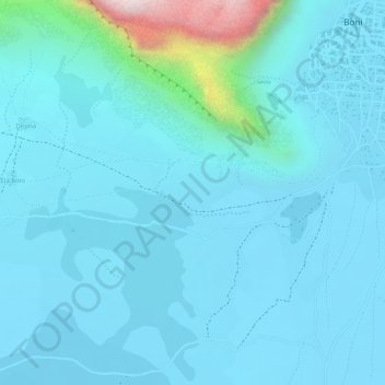
Name: swale topographic map, elevation, terrain.
Location: swale, Douentza Cercle, Mopti, Mali (15.06322 -2.23561 15.06662 -2.22857)
Average elevation: 335 m
Minimum elevation: 277 m
Maximum elevation: 787 m
Other topographic maps
Click on a map to view its topography, its elevation and its terrain.
Banani
Mali > Mopti > Bandiagara Cercle
Banani, Bandiagara Cercle, Mopti, Mali
Average elevation: 413 m
Bandiagara
Mali > Mopti > Bandiagara Cercle
Bandiagara, Bandiagara Cercle, Mopti, Mali
Average elevation: 436 m
Kandara
Mali > Mopti > Djenné Cercle > Kandara
Kandara, Djenné Cercle, Mopti, Mali
Average elevation: 271 m