
Skeleton Coast Park topographic map
Interactive map
Click on the map to display elevation.
About this map
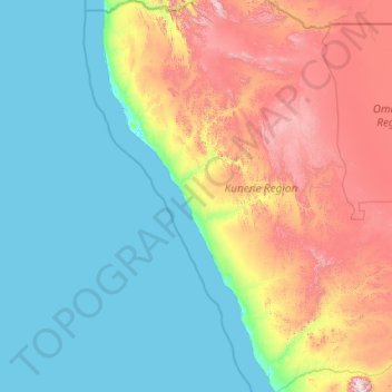
Name: Skeleton Coast Park topographic map, elevation, terrain.
Location: Skeleton Coast Park, Kunene Region, Namibia (-21.19346 11.73672 -17.15111 13.96122)
Average elevation: 478 m
Minimum elevation: -2 m
Maximum elevation: 2,397 m
Other topographic maps
Click on a map to view its topography, its elevation and its terrain.
Damaraland
Namibia > Kunene Region > Vrede
Damaraland, C39, Vrede, Kunene Region, Namibia
Average elevation: 831 m
Sesfontein
Namibia > Kunene Region > Sesfontein
Sesfontein, Kunene Region, Namibia
Average elevation: 608 m
Kamanjab
Namibia > Kunene Region > Kamanjab
Kamanjab, Kunene Region, Namibia
Average elevation: 1,218 m