
辰巳ダム topographic map
Interactive map
Click on the map to display elevation.
About this map
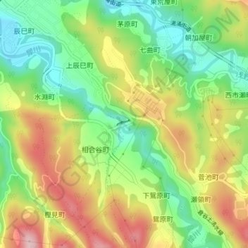
Name: 辰巳ダム topographic map, elevation, terrain.
Location: 辰巳ダム, 相合谷町, 金沢市, 石川県, 9201322, 日本 (36.49789 136.71281 36.49867 136.71484)
Average elevation: 171 m
Minimum elevation: 72 m
Maximum elevation: 296 m
Other topographic maps
Click on a map to view its topography, its elevation and its terrain.