
Garon topographic map
Interactive map
Click on the map to display elevation.
About this map
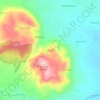
Name: Garon topographic map, elevation, terrain.
Location: Garon, Magetan, East Java, Indonesia (-7.73397 111.37640 -7.69397 111.41640)
Average elevation: 214 m
Minimum elevation: 103 m
Maximum elevation: 415 m
Other topographic maps
Click on a map to view its topography, its elevation and its terrain.
Bayemtaman
Indonesia > East Java > Magetan
Bayemtaman, Magetan, East Java, Java, 63395, Indonesia
Average elevation: 62 m
Gunung Lawu
Indonesia > East Java > Magetan
Gunung Lawu, Gunung Lawu Track via Cemoro Kandang, Magetan, East Java, Java, Indonesia
Average elevation: 2,881 m