
Dolwyddelan topographic map
Interactive map
Click on the map to display elevation.
About this map
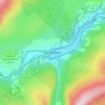
Name: Dolwyddelan topographic map, elevation, terrain.
Location: Dolwyddelan, Conwy, Wales, LL25 0SQ, United Kingdom (53.03296 -3.90909 53.07296 -3.86909)
Average elevation: 275 m
Minimum elevation: 130 m
Maximum elevation: 594 m
Conwy trails, hiking, mountain biking, running and outdoor activities
Other topographic maps
Click on a map to view its topography, its elevation and its terrain.