
Rhos-on-Sea topographic map
Click on the map to display elevation.
About this map
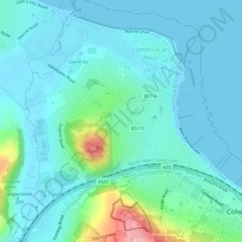
Name: Rhos-on-Sea topographic map, elevation, terrain.
Location: Rhos-on-Sea, Conwy, Wales, United Kingdom (53.29231 -3.76810 53.31851 -3.72875)
Average elevation: 23 m
Minimum elevation: -1 m
Maximum elevation: 135 m
Conwy trails, hiking, mountain biking, running and outdoor activities
Other topographic maps
Click on a map to view its topography, its elevation and its terrain.
Gwyrch Castle Northern Towers
United Kingdom > Wales > Conwy > Llanddulas > Terfyn
Average elevation: 54 m