
Capelulo topographic map
Click on the map to display elevation.
About this map
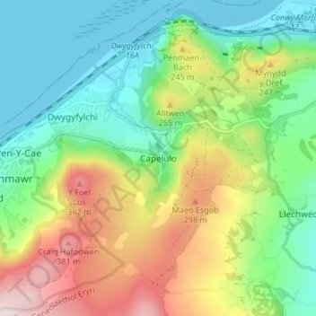
Name: Capelulo topographic map, elevation, terrain.
Location: Capelulo, Conwy, Wales, LL34 6SR, United Kingdom (53.25073 -3.90547 53.29073 -3.86547)
Average elevation: 148 m
Minimum elevation: 0 m
Maximum elevation: 418 m
Conwy trails, hiking, mountain biking, running and outdoor activities
Other topographic maps
Click on a map to view its topography, its elevation and its terrain.