
Ysbyty Ifan topographic map
Interactive map
Click on the map to display elevation.
About this map
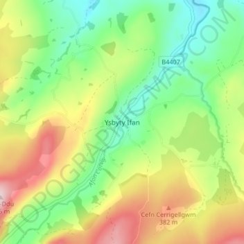
Name: Ysbyty Ifan topographic map, elevation, terrain.
Location: Ysbyty Ifan, Conwy, Wales, LL24 0NS, United Kingdom (53.00444 -3.74723 53.04444 -3.70723)
Average elevation: 294 m
Minimum elevation: 185 m
Maximum elevation: 455 m
Conwy trails, hiking, mountain biking, running and outdoor activities
Other topographic maps
Click on a map to view its topography, its elevation and its terrain.