
Hoath topographic map
Interactive map
Click on the map to display elevation.
About this map
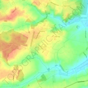
Name: Hoath topographic map, elevation, terrain.
Location: Hoath, Canterbury, Kent, England, United Kingdom (51.31882 1.13243 51.35303 1.18908)
Average elevation: 24 m
Minimum elevation: 0 m
Maximum elevation: 46 m
Kent trails, hiking, mountain biking, running and outdoor activities
Other topographic maps
Click on a map to view its topography, its elevation and its terrain.
Reculver Country Park
United Kingdom > England > Kent > Canterbury > Hillborough
Average elevation: 10 m
Shalmsford Street
United Kingdom > England > Kent > Canterbury > Shalmsford Street
Average elevation: 54 m