
Sturry topographic map
Click on the map to display elevation.
About this map
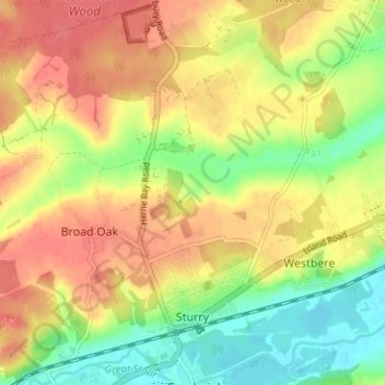
Name: Sturry topographic map, elevation, terrain.
Location: Sturry, Canterbury, Kent, England, United Kingdom (51.29568 1.08458 51.33499 1.14726)
Average elevation: 32 m
Minimum elevation: -2 m
Maximum elevation: 58 m
Kent trails, hiking, mountain biking, running and outdoor activities
Other topographic maps
Click on a map to view its topography, its elevation and its terrain.
Shalmsford Street
United Kingdom > England > Kent > Canterbury > Shalmsford Street
Average elevation: 54 m
Reculver Country Park
United Kingdom > England > Kent > Canterbury > Hillborough
Average elevation: 10 m