
Make a donation
Gear up for your next adventure:
As an Amazon Associate, this site earns from qualifying purchases at no extra cost to you.
Entoto Knob topographic map
Click on the map to display elevation.
Make a donation
Gear up for your next adventure:
As an Amazon Associate, this site earns from qualifying purchases at no extra cost to you.
About this map
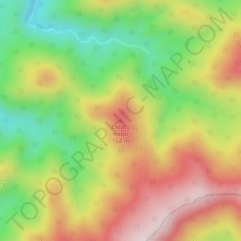
Name: Entoto Knob topographic map, elevation, terrain.
Location: Entoto Knob, Rockbridge County, Virginia, United States (37.65286 -79.38786 37.65296 -79.38776)
Average elevation: 583 m
Minimum elevation: 335 m
Maximum elevation: 840 m
Make a donation
Gear up for your next adventure:
As an Amazon Associate, this site earns from qualifying purchases at no extra cost to you.
Other topographic maps
Click on a map to view its topography, its elevation and its terrain.
Blacksburg
United States > Virginia > Montgomery County
Blacksburg exhibits a varied topography characterized by its rolling hills and elevation changes. The town is situated at an average elevation of approximately 2,040 feet (621 meters) above sea level, with elevations ranging from about 1,440 feet (440 meters) to peaks reaching approximately 2,800 feet (860…
Average elevation: 621 m
Make a donation
Gear up for your next adventure:
As an Amazon Associate, this site earns from qualifying purchases at no extra cost to you.
Roanoke
Roanoke is characterized by a diverse topography, nestled within the Appalachian Mountains and the scenic Blue Ridge region. The city is situated at an elevation of approximately 1,100 feet, with the surrounding terrain consisting of rolling hills and valleys, predominantly shaped by the nearby Roanoke River.…
Average elevation: 333 m
Fredericksburg
Fredericksburg is characterized by its varied topography, which plays a significant role in the region's historical and recreational appeal. The city is situated on rolling hills that rise gently from the banks of the Rappahannock River, creating a picturesque landscape. The river itself meanders through the…
Average elevation: 38 m
Make a donation
Gear up for your next adventure:
As an Amazon Associate, this site earns from qualifying purchases at no extra cost to you.
Alexandria
Alexandria, Virginia, is characterized by a diverse topography that features both flat and gently rolling landscapes, primarily situated along the banks of the Potomac River. The city sits at an average elevation of about 100 feet above sea level, with some areas dipping to nearly 5 feet below sea level near…
Average elevation: 23 m
Make a donation
Gear up for your next adventure:
As an Amazon Associate, this site earns from qualifying purchases at no extra cost to you.
Make a donation
Gear up for your next adventure:
As an Amazon Associate, this site earns from qualifying purchases at no extra cost to you.
Lee County
The county contains karst, a type of topography, within an area of Ordovician limestone called "the Cedars." The Powell River flows through Lee County on its way to Tennessee.
Average elevation: 548 m
Front Royal
United States > Virginia > Warren County
Front Royal, located in Warren County, Virginia, sits at an elevation of approximately 570 feet (174 meters) above sea level. It lies in a diverse topographic region, with the town nestled at the confluence of the North and South Forks of the Shenandoah River, which contributes to its distinctive river…
Average elevation: 194 m
Make a donation
Gear up for your next adventure:
As an Amazon Associate, this site earns from qualifying purchases at no extra cost to you.
Leesburg
United States > Virginia > Loudoun County
Leesburg is located northeast of the center of Loudoun County at 39°7′N 77°33′W / 39.117°N 77.550°W / 39.117; -77.550 (39.109, −77.558), It is part of the northern Virginia Piedmont and sits at the base of the easternmost chain of the Blue Ridge Mountains, Catoctin Mountain. The town lies in…
Average elevation: 113 m
Fairfax County
Most of the county lies in the Piedmont region, with rolling hills and deep stream valleys such as Difficult Run and its tributaries. West of Route 28, the hills give way to a flat, gentle valley that stretches west to the Bull Run Mountains in Loudoun County. Elevations in the county range from near sea level…
Average elevation: 75 m
Make a donation
Gear up for your next adventure:
As an Amazon Associate, this site earns from qualifying purchases at no extra cost to you.
Shenandoah National Park
United States > Virginia > Page County
Shenandoah National Park lies along the Blue Ridge Mountains in north-central Virginia. These mountains form a distinct highland rising to elevations above 4,000 feet (1,200 m). Local topographic relief between the Blue Ridge Mountains and Shenandoah Valley exceeds 3,000 feet (910 m) at some locations. The…
Average elevation: 335 m
Make a donation
Gear up for your next adventure:
As an Amazon Associate, this site earns from qualifying purchases at no extra cost to you.
Make a donation
Gear up for your next adventure:
As an Amazon Associate, this site earns from qualifying purchases at no extra cost to you.
Galax
The area that later became Galax was part of an 800-acre (320 ha) land grant given to James Buchanan in 1756 by the British Crown. The first plat map for Galax is dated December 1903; The town founders selected the site for the city on a wide expanse of meadowland bisected by Chestnut Creek and sitting at an…
Average elevation: 766 m
Make a donation
Gear up for your next adventure:
As an Amazon Associate, this site earns from qualifying purchases at no extra cost to you.
Make a donation
Gear up for your next adventure:
As an Amazon Associate, this site earns from qualifying purchases at no extra cost to you.
Make a donation
Gear up for your next adventure:
As an Amazon Associate, this site earns from qualifying purchases at no extra cost to you.
Ashburn
United States > Virginia > Loudoun County > Ashburn
Ashburn is located at 39°02′37″N 077°29′15″W / 39.04361°N 77.48750°W / 39.04361; -77.48750 (39.0437192, −77.4874899) and its average elevation is 295 feet (90 m) above sea level. According to the 2010 United States Census, the CDP has a total area of 17.287 square miles (44.77 km2), of…
Average elevation: 86 m
Floyd County
Floyd County is situated atop a high plateau of the Blue Ridge Mountains which divides the eastward flowing from the westward flowing waters. With the high topography, no streams flow into Floyd County. The county is drained primarily by Little River and its tributaries which flow into New River below the…
Average elevation: 707 m
Make a donation
Gear up for your next adventure:
As an Amazon Associate, this site earns from qualifying purchases at no extra cost to you.
Make a donation
Gear up for your next adventure:
As an Amazon Associate, this site earns from qualifying purchases at no extra cost to you.
Make a donation
Gear up for your next adventure:
As an Amazon Associate, this site earns from qualifying purchases at no extra cost to you.
Make a donation
Gear up for your next adventure:
As an Amazon Associate, this site earns from qualifying purchases at no extra cost to you.
Lynchburg
Lynchburg has a four-season humid subtropical climate (Köppen Cfa), with cool winters and hot, humid summers. The monthly daily average temperature ranges from 35.9 °F (2.2 °C) in January to 76.0 °F (24.4 °C) in July. Nights tend to be significantly cooler than days throughout much of the year due in part…
Average elevation: 229 m
Make a donation
Gear up for your next adventure:
As an Amazon Associate, this site earns from qualifying purchases at no extra cost to you.
McLean
United States > Virginia > Fairfax County > McLean
McLean is located at 38°56′03″N 77°10′39″W / 38.93417°N 77.17750°W / 38.93417; -77.17750 (38.9342776, −77.1774801) at an elevation of 285 feet (87 m). Located on the Capital Beltway (Interstate 495) in Northern Virginia, central McLean is 8 miles (13 km) northwest of downtown Washington,…
Average elevation: 89 m
Make a donation
Gear up for your next adventure:
As an Amazon Associate, this site earns from qualifying purchases at no extra cost to you.
Fauquier County
According to the U.S. Census Bureau, the county has an area of 651 square miles (1,690 km2), of which 647 square miles (1,680 km2) is land and 3.8 square miles (9.8 km2) (0.6%) is water. Fauquier county is not densely populated, but exurban development from Washington, DC has sprung up in some parts. Even in…
Average elevation: 152 m
Make a donation
Gear up for your next adventure:
As an Amazon Associate, this site earns from qualifying purchases at no extra cost to you.
Make a donation
Gear up for your next adventure:
As an Amazon Associate, this site earns from qualifying purchases at no extra cost to you.
Amelia County
Amelia County is drained by tributaries of the Appomattox. The lowest elevation in the county is 158 feet (48 m), on Lake Chesdin on the Appomattox at the eastern extremity of the county. The highest elevation is 525 feet (160 m), on SR 616 (S. Genito Road) at the community of Gills in the southwest corner of…
Average elevation: 103 m
Make a donation
Gear up for your next adventure:
As an Amazon Associate, this site earns from qualifying purchases at no extra cost to you.
Make a donation
Gear up for your next adventure:
As an Amazon Associate, this site earns from qualifying purchases at no extra cost to you.
Make a donation
Gear up for your next adventure:
As an Amazon Associate, this site earns from qualifying purchases at no extra cost to you.
Virginia Beach
According to the United States Census Bureau, the city has a total area of 497 square miles (1,290 km2), of which 249 square miles (640 km2) is land and 248 square miles (640 km2) (49.9%) is water. It is the largest city in Virginia by total area and third-largest city by land area. The average elevation is 12…
Average elevation: 2 m
Make a donation
Gear up for your next adventure:
As an Amazon Associate, this site earns from qualifying purchases at no extra cost to you.
Make a donation
Gear up for your next adventure:
As an Amazon Associate, this site earns from qualifying purchases at no extra cost to you.
Colonial Heights
According to The Comparative Guide to American Suburbs, Colonial Heights's elevation is 95 feet.
Average elevation: 22 m
Make a donation
Gear up for your next adventure:
As an Amazon Associate, this site earns from qualifying purchases at no extra cost to you.