
Llandudno Junction topographic map
Interactive map
Click on the map to display elevation.
About this map
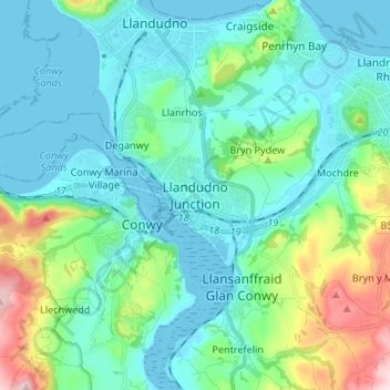
Name: Llandudno Junction topographic map, elevation, terrain.
Location: Llandudno Junction, Conwy, Wales, LL31 9NY, United Kingdom (53.24713 -3.85050 53.32713 -3.77050)
Average elevation: 60 m
Minimum elevation: -1 m
Maximum elevation: 302 m
Conwy trails, hiking, mountain biking, running and outdoor activities
Other topographic maps
Click on a map to view its topography, its elevation and its terrain.