
Sutton-at-Hone and Hawley topographic map
Interactive map
Click on the map to display elevation.
About this map
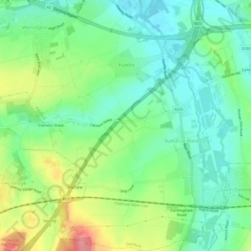
Name: Sutton-at-Hone and Hawley topographic map, elevation, terrain.
Average elevation: 39 m
Minimum elevation: 7 m
Maximum elevation: 101 m
Other topographic maps
Click on a map to view its topography, its elevation and its terrain.
Swanscombe and Greenhithe
United Kingdom > England > Dartford
Swanscombe and Greenhithe, Dartford, Kent, South East, England, United Kingdom
Average elevation: 15 m
Southfleet
United Kingdom > England > Dartford > Southfleet
Southfleet, Station Road, Southfleet, Dartford, Kent, South East England, England, DA13 9LH, United Kingdom
Average elevation: 31 m
Maypole
United Kingdom > England > Dartford > Maypole
Maypole, Dartford, Kent, South East England, England, DA2 7WA, United Kingdom
Average elevation: 39 m
Darenth
United Kingdom > England > Dartford
Darenth, Dartford, Kent, South East, England, United Kingdom
Average elevation: 40 m
Longfield and New Barn
United Kingdom > England > Dartford
Longfield and New Barn, Dartford, Kent, South East, England, United Kingdom
Average elevation: 73 m
Joydens Wood
United Kingdom > England > Dartford
Joydens Wood, Woodland Way, Stonehill Woods Park, Joydens Wood, Dartford, Kent, South East, England, DA14 5AS, United Kingdom
Average elevation: 50 m
Stone
United Kingdom > England > Dartford
Stone, Dartford, Kent, South East, England, United Kingdom
Average elevation: 20 m