
Eisenborn topographic map
Interactive map
Click on the map to display elevation.
About this map
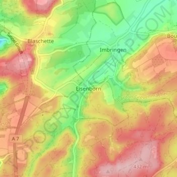
Name: Eisenborn topographic map, elevation, terrain.
Location: Eisenborn, Junglinster, Canton Grevenmacher, 6196, Luxembourg (49.67122 6.16452 49.71122 6.20452)
Average elevation: 366 m
Minimum elevation: 275 m
Maximum elevation: 444 m
Other topographic maps
Click on a map to view its topography, its elevation and its terrain.