
Mertert topographic map
Interactive map
Click on the map to display elevation.
About this map
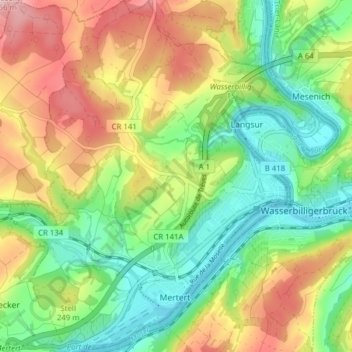
Name: Mertert topographic map, elevation, terrain.
Location: Mertert, Canton Grevenmacher, Luxembourg (49.69235 6.44481 49.74265 6.51715)
Average elevation: 225 m
Minimum elevation: 129 m
Maximum elevation: 365 m
Other topographic maps
Click on a map to view its topography, its elevation and its terrain.