
Diamamouve topographic map
Interactive map
Click on the map to display elevation.
About this map
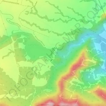
Name: Diamamouve topographic map, elevation, terrain.
Location: Diamamouve, Flacq, Outer islands of Mauritius, Mauritius (-20.31395 57.66429 -20.31134 57.66526)
Average elevation: 266 m
Minimum elevation: 150 m
Maximum elevation: 404 m
Other topographic maps
Click on a map to view its topography, its elevation and its terrain.
Grand River South-East
Mauritius > Flacq > Grand River South-East
Grand River South-East, Flacq, 42211, Mauritius
Average elevation: 22 m