
Tamberías topographic map
Interactive map
Click on the map to display elevation.
About this map
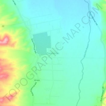
Name: Tamberías topographic map, elevation, terrain.
Location: Tamberías, Calingasta, San Juan, Argentina (-31.47811 -69.44169 -31.43811 -69.40169)
Average elevation: 1,474 m
Minimum elevation: 1,434 m
Maximum elevation: 1,598 m
Other topographic maps
Click on a map to view its topography, its elevation and its terrain.