
Fuzuli topographic map
Interactive map
Click on the map to display elevation.
About this map
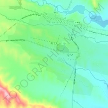
Name: Fuzuli topographic map, elevation, terrain.
Location: Fuzuli, Fizuli District, Azerbaijan (39.57961 47.12420 39.61320 47.18062)
Average elevation: 419 m
Minimum elevation: 360 m
Maximum elevation: 571 m
Other topographic maps
Click on a map to view its topography, its elevation and its terrain.
Dashkasan District
The district covers the Dashkasan plateau of the Lesser Caucasian Mountain range encompassing parts and tips of Shahdagh and Murovdag ranges. The highest altitudes are at Hinaldag Peak (3,367 meters) and Qoshqar Peak (3,361 meters). Part of Bashkend-Dastafur lowlands also falls in Dashkasan rayon. This part of…
Average elevation: 1,771 m
Goygol District
The region's highest point reaches an elevation of 3,724 metres above the sea level. Goygol District borders the administrative districts of Samukh to the north, Goranboy to the east, Kalbajar to the south, Dashkasan to the west, Shamkir to the north-west and Ganja city to the north. The total area of the…
Average elevation: 1,217 m
Ismailli District
The landscape is mainly composed of mountains. Altitudes vary between 200 and 3629 meters (Babadagh) above sea level. The area is passed by the Goychay, Gyrdyman, Akhokh, Ayrichay, Sulut and other rivers, Yekekhana and Ashygbayram artificial ponds.
Average elevation: 1,009 m
Goygol District
Goygol and 7 identical lakes – Maralgol, Zaligol, Aghgol, Shamligol, Ordekgol, Jeyrangol and Garagol are located in the territory of Goygol district. Lake Goygol is situated on the foothill of Mount Kapaz at an altitude of 1556 meters. The length of the lake is 2450 meters, and its width is 595 meters, the…
Average elevation: 1,217 m
Shirvan District
Throughout its history, Shirvan has suffered from floods because of its proximity to the river and the relatively low elevation of most of the town.
Average elevation: 13 m
Quba-Khachmaz
The climate of the region has special topographic characteristic with four different zones. Clime types are divided into hot in the plain zones, cold-humid and cold in the mountain zones.
Average elevation: 647 m
Nakhchivan
Nakhchivan (Azerbaijani: Naxçıvan [nɑxtʃɯˈvɑn]; Armenian: Նախիջևան, romanized: Nakhijevan) is the capital of the eponymous Nakhchivan Autonomous Republic of Azerbaijan, located 450 km (280 mi) west of Baku. The municipality of Nakhchivan consists of the city of Nakhchivan, the settlement of…
Average elevation: 886 m