
County Donegal topographic map
Interactive map
Click on the map to display elevation.
County Donegal
The majority of Donegal has a temperate oceanic climate (Köppen climate classification: Cfb), with upland areas in the Derryveagh and Blue Stack ranges classified as oceanic subpolar (Köppen climate classification: Cfc). The county's climate is heavily influenced by the North Atlantic Current. Due to the topography of western Donegal, it receives orographic rainfall, where the air is forced to rise on contact with its mountainous coastline and subsequently cools and condenses, forming clouds. The mountains of Donegal are among the cloudiest places in Ireland, and northern Donegal is the windiest. Irish monthly record wind speeds for March, June, July, September, November and December have all been set at Malin Head. The highest wind speed ever recorded in Donegal was 181 km/h (112 mph) on 16 September 1961, during Hurricane Debbie.
About this map
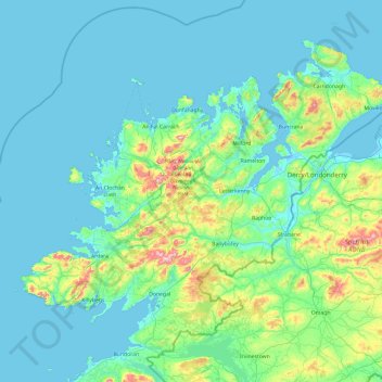
Name: County Donegal topographic map, elevation, terrain.
Location: County Donegal, Ulster, Ireland (54.45905 -8.83471 55.43530 -6.92273)
Average elevation: 74 m
Minimum elevation: -4 m
Maximum elevation: 697 m
Other topographic maps
Click on a map to view its topography, its elevation and its terrain.
Templeglantine
Ireland > County Limerick > The Municipal District of Newcastle West
Average elevation: 189 m
Castleknock
As the word Castle did not come into use in Ireland until Norman times we know that Castleknock is a name of comparatively recent origin. Documents from the 12th and 13th centuries refer to the place as Castrum Cnoc, simply Cnoc and also Chastel-cnoc or Castel-Cnoc. So it seems that the name Castleknock is…
Average elevation: 55 m
Great Skellig
Skellig Michael consists of approximately 22 hectares (54 acres) of rock, with its highest point, known as the Spit, 218 m (714 ft) above sea level. The island is defined by its twin peaks and intervening valley (known as Christ's Saddle), which make its landscape steep and inhospitable. It is best known for…
Average elevation: 1 m