Geolocate

Carmarthenshire topographic maps

Click on a map to view its topography, its elevation and its terrain.
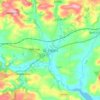
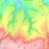
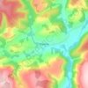
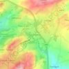
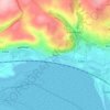
St Clears

United Kingdom > Wales > Carmarthenshire

Average elevation: 49 m

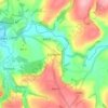
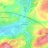
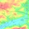
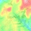
Llansteffan

United Kingdom > Wales > Carmarthenshire

Average elevation: 46 m

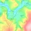
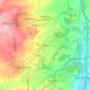
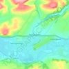
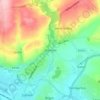
Gorslas

United Kingdom > Wales > Carmarthenshire

Average elevation: 174 m

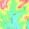
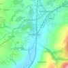
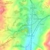
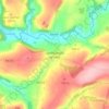
Trap

United Kingdom > Wales > Carmarthenshire

Average elevation: 185 m

Llanddowror

United Kingdom > Wales > Carmarthenshire

Average elevation: 50 m

Red Roses

United Kingdom > Wales > Carmarthenshire

Average elevation: 149 m

Rhydcymerau

United Kingdom > Wales > Carmarthenshire

Average elevation: 256 m

Pumsaint

United Kingdom > Wales > Carmarthenshire

Average elevation: 181 m

Cilycwm

United Kingdom > Wales > Carmarthenshire

Average elevation: 154 m

Edwinsford

United Kingdom > Wales > Carmarthenshire

Average elevation: 153 m

Abergorlech

United Kingdom > Wales > Carmarthenshire

Average elevation: 182 m

Talley

United Kingdom > Wales > Carmarthenshire

Average elevation: 174 m

Gwyddgrug

United Kingdom > Wales > Carmarthenshire > New Inn

Average elevation: 216 m

Pencader

United Kingdom > Wales > Carmarthenshire

Average elevation: 182 m

Penboyr

United Kingdom > Wales > Carmarthenshire > Cwmpengraig

Average elevation: 181 m

Llangeler

United Kingdom > Wales > Carmarthenshire

Average elevation: 99 m

Velindre

United Kingdom > Wales > Carmarthenshire > Drefach

Average elevation: 114 m

Cenarth

United Kingdom > Wales > Carmarthenshire

Average elevation: 79 m

Ffarmers

United Kingdom > Wales > Carmarthenshire

Average elevation: 224 m

Banc Y Garth

United Kingdom > Wales > Carmarthenshire

Average elevation: 342 m

Ammanford

United Kingdom > Wales > Carmarthenshire

Average elevation: 142 m

Whitland

United Kingdom > Wales > Carmarthenshire

Average elevation: 86 m

Cynwyl Elfed

United Kingdom > Wales > Carmarthenshire

Average elevation: 150 m

Burry Port

United Kingdom > Wales > Carmarthenshire

Average elevation: 36 m

Kidwelly

United Kingdom > Wales > Carmarthenshire

Average elevation: 52 m

Llanfallteg

United Kingdom > Wales > Carmarthenshire

Average elevation: 65 m

Llanboidy

United Kingdom > Wales > Carmarthenshire

Average elevation: 137 m

Llanarthney

United Kingdom > Wales > Carmarthenshire

Average elevation: 57 m

Nantgaredig

United Kingdom > Wales > Carmarthenshire

Average elevation: 54 m

Cefneithin

United Kingdom > Wales > Carmarthenshire

Average elevation: 156 m

Tumble

United Kingdom > Wales > Carmarthenshire

Average elevation: 156 m

Laugharne

United Kingdom > Wales > Carmarthenshire

Average elevation: 38 m

Llanegwad

United Kingdom > Wales > Carmarthenshire

Average elevation: 46 m

Llanwrda

United Kingdom > Wales > Carmarthenshire

Average elevation: 100 m

Llangadog

United Kingdom > Wales > Carmarthenshire

Average elevation: 65 m

Tycroes

United Kingdom > Wales > Carmarthenshire

Topographically, the village slopes in a general south west to north east direction thus affording panoramic views of the Black Mountain in the east with its peaks - Tair Cairn 482 m, Garreg Lwyd 616 m and behind them Fan Hir 802 m. To the south there are views from Betws Mountain to Mynydd y Gwair above…

Average elevation: 81 m
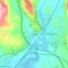
Hendy

United Kingdom > Wales > Carmarthenshire

Average elevation: 41 m

Llangennech

United Kingdom > Wales > Carmarthenshire

Average elevation: 37 m

Dafen

United Kingdom > Wales > Carmarthenshire

Average elevation: 43 m

Pontyberem

United Kingdom > Wales > Carmarthenshire

Average elevation: 118 m

Brechfa

United Kingdom > Wales > Carmarthenshire

Average elevation: 169 m

Porthyrhyd

United Kingdom > Wales > Carmarthenshire

Average elevation: 105 m

Saron

United Kingdom > Wales > Carmarthenshire

Average elevation: 97 m

Pantyffynnon

United Kingdom > Wales > Carmarthenshire

Average elevation: 72 m

Cross Hands

United Kingdom > Wales > Carmarthenshire

Average elevation: 163 m

Llanddarog

United Kingdom > Wales > Carmarthenshire

Average elevation: 90 m

Penybanc

United Kingdom > Wales > Carmarthenshire

Average elevation: 69 m

Pwll

United Kingdom > Wales > Carmarthenshire

Average elevation: 49 m

Horeb

United Kingdom > Wales > Carmarthenshire > Five Roads

Average elevation: 156 m

Felinfoel

United Kingdom > Wales > Carmarthenshire

Average elevation: 66 m

Cwmann

United Kingdom > Wales > Carmarthenshire

Average elevation: 166 m

Betws

United Kingdom > Wales > Carmarthenshire

Average elevation: 87 m

Llanybri

United Kingdom > Wales > Carmarthenshire

Average elevation: 67 m

Garnant

United Kingdom > Wales > Carmarthenshire

Average elevation: 186 m

Glanamman

United Kingdom > Wales > Carmarthenshire

Average elevation: 188 m

Carmel

United Kingdom > Wales > Carmarthenshire

Average elevation: 181 m
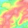
Idole

United Kingdom > Wales > Carmarthenshire

Average elevation: 75 m

Llannon

United Kingdom > Wales > Carmarthenshire

Average elevation: 180 m

Bethlehem

United Kingdom > Wales > Carmarthenshire

Average elevation: 115 m

Meinciau

United Kingdom > Wales > Carmarthenshire

Average elevation: 125 m

Trimsaran

United Kingdom > Wales > Carmarthenshire

Average elevation: 74 m

Manordeilo

United Kingdom > Wales > Carmarthenshire

Average elevation: 67 m

Login

United Kingdom > Wales > Carmarthenshire

Average elevation: 126 m

Crug-y-bar

United Kingdom > Wales > Carmarthenshire

Average elevation: 167 m

Llanfynydd

United Kingdom > Wales > Carmarthenshire

Average elevation: 186 m

Pencarreg

United Kingdom > Wales > Carmarthenshire

Average elevation: 152 m

Llanybydder

United Kingdom > Wales > Carmarthenshire

Average elevation: 147 m

Pontyates

United Kingdom > Wales > Carmarthenshire

Average elevation: 82 m

Bancycapel

United Kingdom > Wales > Carmarthenshire > Idole

Average elevation: 99 m

Capel Iwan

United Kingdom > Wales > Carmarthenshire

Average elevation: 159 m

Cwmhiraeth

United Kingdom > Wales > Carmarthenshire > Waungilwen

Average elevation: 145 m

Mynydd Sylen

United Kingdom > Wales > Carmarthenshire

Average elevation: 208 m

Nantycaws

United Kingdom > Wales > Carmarthenshire

Average elevation: 89 m

Pen Y Mynydd

United Kingdom > Wales > Carmarthenshire > Trimsaran

Average elevation: 114 m

Dryslwyn

United Kingdom > Wales > Carmarthenshire

Average elevation: 58 m

Efailwen

United Kingdom > Wales > Carmarthenshire

Average elevation: 165 m

Capel Isaac

United Kingdom > Wales > Carmarthenshire

Average elevation: 150 m

Mynydd Mallaen

United Kingdom > Wales > Carmarthenshire

Average elevation: 388 m

Pontwelly

United Kingdom > Wales > Carmarthenshire

Average elevation: 121 m
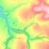
Rhandirmwyn

United Kingdom > Wales > Carmarthenshire

Average elevation: 243 m
Aber-Giar

United Kingdom > Wales > Carmarthenshire
Average elevation: 177 m

Llanllawddog

United Kingdom > Wales > Carmarthenshire

Average elevation: 184 m

Glandwr

United Kingdom > Wales > Carmarthenshire > Cenarth

Average elevation: 76 m

Peniel

United Kingdom > Wales > Carmarthenshire

Average elevation: 102 m

Blaen-y-coed

United Kingdom > Wales > Carmarthenshire

Average elevation: 172 m

Tanglwst

United Kingdom > Wales > Carmarthenshire

Average elevation: 223 m

Rhydargaeau

United Kingdom > Wales > Carmarthenshire

Average elevation: 152 m

Rhiwiau

United Kingdom > Wales > Carmarthenshire

Average elevation: 235 m

Llyn y Fan Fach

United Kingdom > Wales > Carmarthenshire

Llyn y Fan Fach (Welsh meaning "little lake of the peak") is a lake of approximately 10 hectares (25 acres) on the northern margin of the Black Mountain in Carmarthenshire, South Wales and lying within the Brecon Beacons National Park. The lake lies at an altitude of approximately 1,660 feet (510 m),…

Average elevation: 549 m
Coed Tregib

United Kingdom > Wales > Carmarthenshire > Llandeilo

Average elevation: 82 m

Afon Bran

United Kingdom > Wales > Carmarthenshire > Llangadog

Average elevation: 57 m

Bryn Iwan

United Kingdom > Wales > Carmarthenshire

Average elevation: 252 m

About this place

 •  •  •  •  •  •  •  •  •  •  •  •  •  •  •  •  •  •  •  •  •  •  •  •

Gear up for your next adventure:

🧭GPS Trackers - Tracking devices for safety and navigation
🧊Personal Water Filters - Drink safely from mountain streams marked on your map
🔋Lithium AA Batteries - Long-lasting power that performs well in cold mountain weather
🧦Merino Wool Hiking Socks - Moisture-wicking socks to prevent blisters during long mountain walks
🧣Neck Gaiters - Protects against wind and sun on exposed ridges and peaks

As an Amazon Associate, this site earns from qualifying purchases at no extra cost to you.